Photo: The wub, CC BY-SA 4.0
#1 · Landmark · 1 hr 56 min south
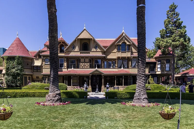
Winchester Mystery House
A huge odd mansion in San Jose with stairs to nowhere and doors that open to walls.
- 1-2 hrs
- Year-round
- See the official site for current fees
Heads-up: Tours have many stairs. Book timed tours ahead.
Plan my day
Official site
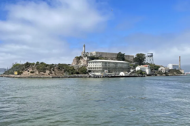
Photo: Chris6d, CC BY-SA 4.0
#2 · Island · 2 hr 12 min southwest
Alcatraz Island
Ferry to the old island prison with an audio tour and big city views.
- Half day
- Year-round when ferry is running
- See the official site for current fees
Heads-up: Island and ferry closed Oct 26 to Nov 18, 2026 for dock repairs (confirm before you go). Book only on the official site. Tickets sell out weeks ahead.
Plan my day
Official site
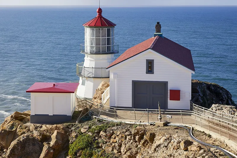
Photo: Frank Schulenburg, CC BY-SA 4.0
#3 · Landmark · 2 hr 14 min southwest
Point Reyes Lighthouse
A historic lighthouse at the end of a long peninsula road with steep stairs and winter whale watching.
- 2-3 hrs
- Year-round; open Thursday to Monday (confirm before you go); whale season Dec to Apr
- See the official site for current fees
Heads-up: About 300 stairs. Winds are strong. Stairs can close for repairs or weather (confirm before you go). Open limited days (usually Fri-Mon); stairs close in high wind (over 40 mph); check NPS for…
Plan my day
Official site
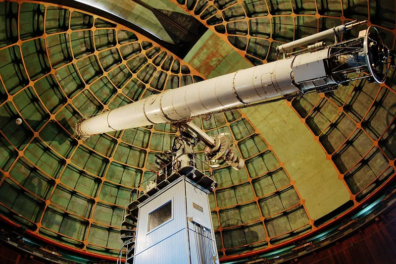
Photo: myyorgda, CC BY 2.0
#4 · Observatory · 2 hr 18 min south
Lick Observatory
Historic hilltop telescopes above San Jose with a long winding road and big views.
- 2-3 hrs
- Grounds open daily; visitor center hours limited (confirm before you go)
- See the official site for current fees
Heads-up: The mountain road is narrow with many curves. No gas up top. Closed on some holidays. Fire and snow closures are possible.
Plan my day
Official site
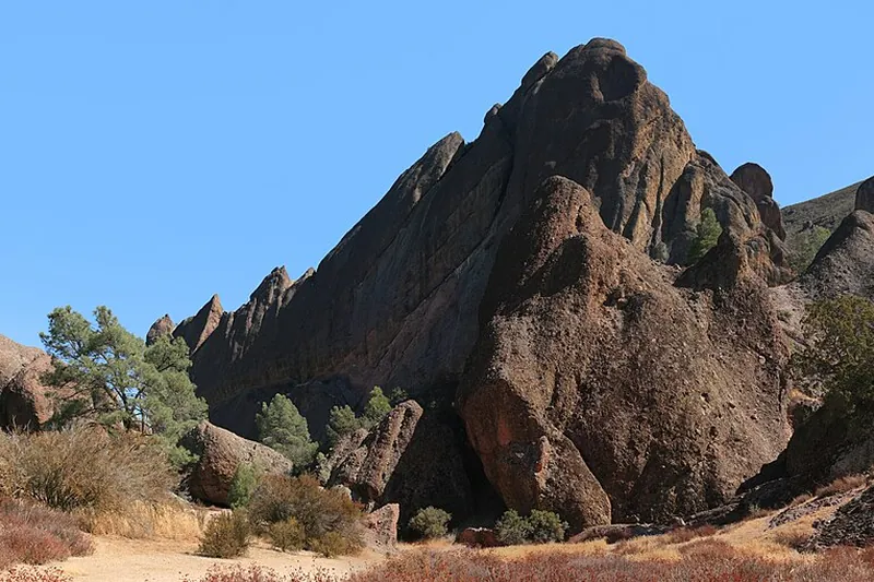
Photo: Brocken Inaglory, CC BY-SA 3.0
#5 · National park · 2 hr 58 min south
Pinnacles National Park
Spires and talus caves from an ancient volcano, plus condors and good hiking trails.
- Half day
- Year-round; best Oct-May
- See the official site for current fees
Heads-up: No road connects the east and west sides. Hot in summer. Dogs are only allowed in parking areas.
Plan my day
Official site
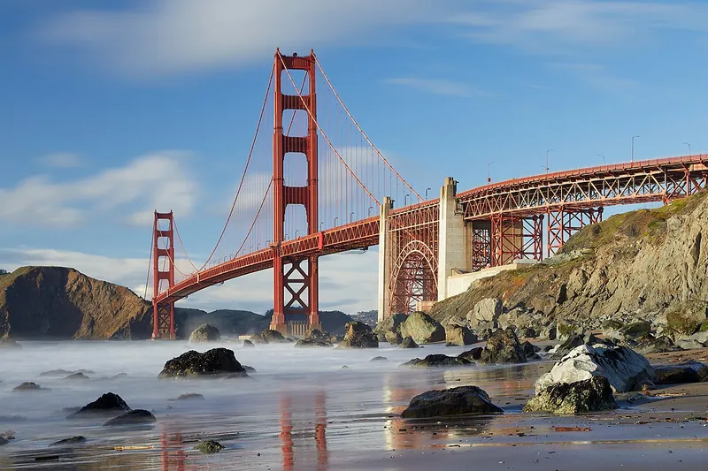
Photo: Frank Schulenburg, CC BY-SA 4.0
#6 · Landmark · 1 hr 37 min southwest
Golden Gate Bridge
The famous orange bridge. Walk or bike across for big views of the city, the bay and the Marin Headlands.
- 1-2 hrs
- Year-round; fog common in summer
- See the official site for current fees
Heads-up: Fog and wind are strong. Parking at the visitor plaza fills early. Bridge toll applies only to southbound cars. Welcome Center at south end; check goldengate.org for hours and parking
Plan my day
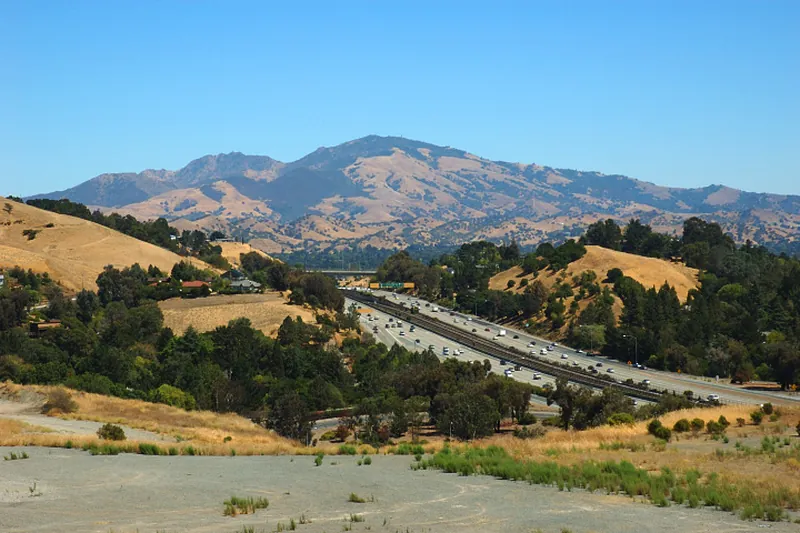
Photo: Trurl66, Public domain
#7 · State park · 1 hr 48 min southwest
Mount Diablo State Park
A tall peak in the East Bay with a summit road, wide views and many trails.
- Half day
- Year-round; spring wildflowers; summit views best on clear days
- See the official site for current fees
Heads-up: Hot in summer. Trails are steep. Dogs on leash in some areas only. Summit Visitor Center open daily 10-4 but its elevator is out of service with no repair date
Plan my day
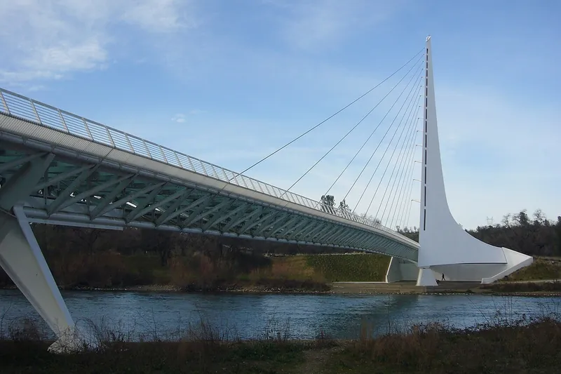
Photo: Chad K, CC BY 2.0
#8 · Landmark · 2 hr 22 min north
Sundial Bridge
A glass-decked footbridge over the Sacramento River in Redding that works as a giant sundial, linked to miles of river trails.
Heads-up: The bridge and trails are always open; summer afternoons are very hot.
Plan my day
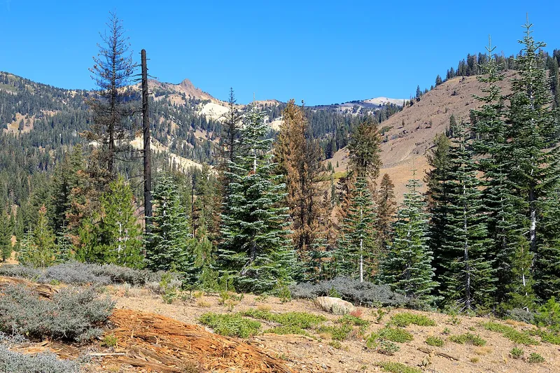
Photo: Frank Schulenburg, CC BY-SA 4.0
#9 · National park · 2 hr 42 min north
Lassen Volcanic National Park
Boiling mud pots, steam vents, lava peaks and clear lakes along one scenic highway in one of the least crowded national parks.
- Full day
- Highway open about June to October
- NPS entrance fee (per vehicle) or America the Beautiful pass
Heads-up: Highway 89 through the park closes for winter, usually by November; then you can drive only to the Kohm Yah-mah-nee Visitor Center or Manzanita Lake. No dogs on trails.
Plan my day
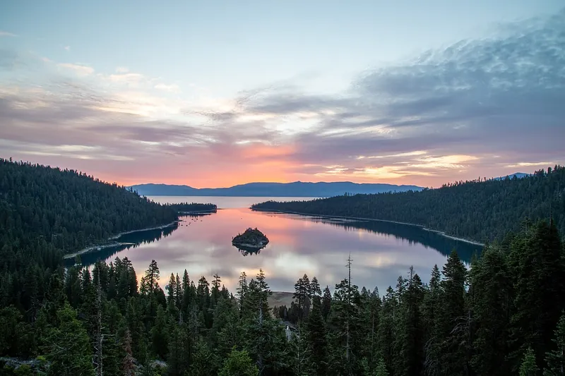
Photo: Eric Philbin, CC0
#10 · State park · 1 hr 55 min east
Emerald Bay State Park
Tahoe's most photographed view: a deep green bay with tiny Fannette Island, seen from the roadside overlooks on Highway 89.
- 1-2 hrs
- Best June to October
- California State Parks day-use fee (per vehicle)
- Confirm fees and hours before you go
Heads-up: Federal passes are not accepted and the lots fill early on summer days. In winter Highway 89 here often needs chains or 4WD, and storms can close the road.
Plan my day
Official site
#11 · Small town · 1 hr 19 min west
Napa Riverfront and Downtown Napa
A walkable downtown with tasting rooms, shops and river views.
- 2-4 hrs
- Year-round
- Free to walk
Heads-up: Parking fills on weekends.
Plan my day
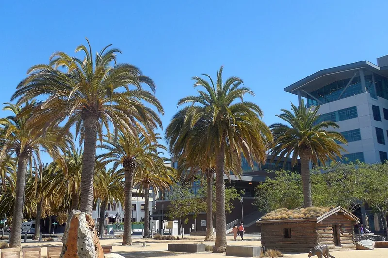
Photo: Niranjan Arminius, CC BY-SA 4.0
#12 · Landmark · 1 hr 21 min southwest
Jack London Square
A waterfront district in Oakland with restaurants, a Sunday farmers market and ferry views.
- 2-3 hrs
- Year-round
- Free to visit
Heads-up: Check market days.
Plan my day
Official site
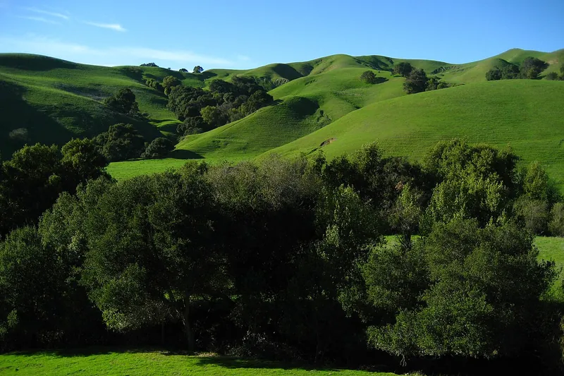
Photo: No machine-readable author provided. Mrbilal1987~commonswiki assumed (based on…, Public domain
#13 · Hike · 1 hr 22 min southwest
Briones Regional Park
Rolling hills with oak woodlands, wildflowers and wide views in Contra Costa County.
- 2-4 hrs
- Year-round; best in spring
- See the official site for current fees
Heads-up: Cattle graze here. Hot in late summer.
Plan my day
Official site
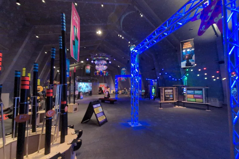
Photo: Tbo47, CC0
#14 · Museum · 1 hr 22 min southwest
Lawrence Hall of Science
Berkeley hills science center with hands-on exhibits and a bay view.
- 2-3 hrs
- Check open days
- See the official site for current fees
Heads-up: Steep drive.
Plan my day
Official site
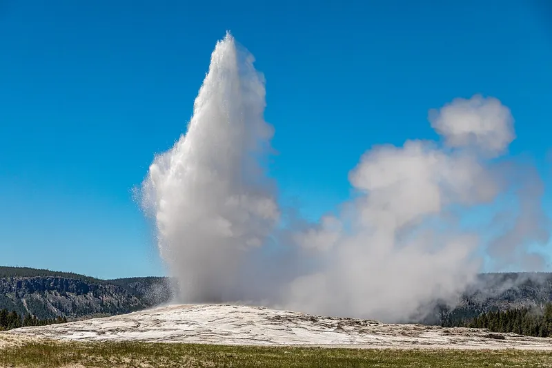
Photo: Dietmar Rabich, CC BY-SA 4.0
#15 · Landmark · 1 hr 29 min west
Old Faithful Geyser of California
A private geyser in Calistoga that erupts on its own schedule.
- 1 hr
- Open daily (confirm before you go)
- See the official site for current fees
Heads-up: Check hours before you go.
Plan my day
Official site