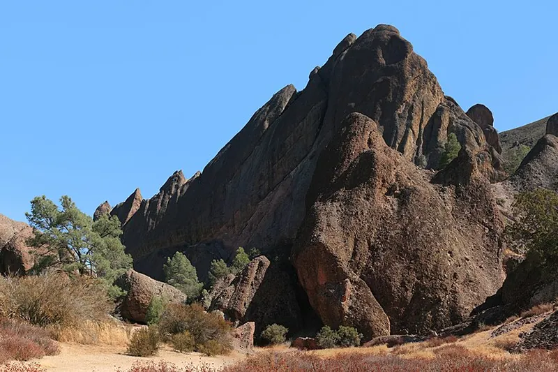
Photo: Brocken Inaglory, CC BY-SA 3.0
#1 · National park · 2 hr 31 min west
Pinnacles National Park
Spires and talus caves from an ancient volcano, plus condors and good hiking trails.
- Half day
- Year-round; best Oct-May
- See the official site for current fees
Heads-up: No road connects the east and west sides. Hot in summer. Dogs are only allowed in parking areas.
Plan my day
Official site
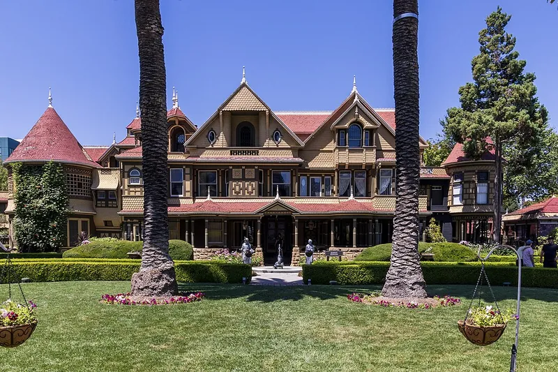
Photo: The wub, CC BY-SA 4.0
#2 · Landmark · 2 hr 32 min west
Winchester Mystery House
A huge odd mansion in San Jose with stairs to nowhere and doors that open to walls.
- 1-2 hrs
- Year-round
- See the official site for current fees
Heads-up: Tours have many stairs. Book timed tours ahead.
Plan my day
Official site
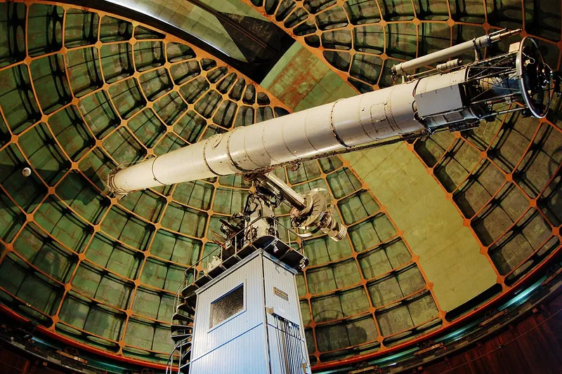
Photo: myyorgda, CC BY 2.0
#3 · Observatory · 2 hr 39 min west
Lick Observatory
Historic hilltop telescopes above San Jose with a long winding road and big views.
- 2-3 hrs
- Grounds open daily; visitor center hours limited (confirm before you go)
- See the official site for current fees
Heads-up: The mountain road is narrow with many curves. No gas up top. Closed on some holidays. Fire and snow closures are possible.
Plan my day
Official site
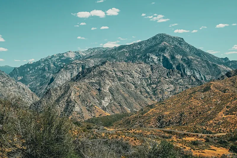
Photo: Guywelch2000, CC BY 4.0
#4 · Scenic drive · 1 hr 21 min east
Kings Canyon Scenic Byway
A dramatic drive into one of the deepest canyons in the US.
- Full day
- Usually open late spring-fall
- See the official site for current fees
Heads-up: Highway 180 closes in winter beyond Hume Lake. Highway 180 beyond Hume Lake Road to Cedar Grove usually closes mid-November for winter and reopens late April; open as of Nov 1 2026
Plan my day
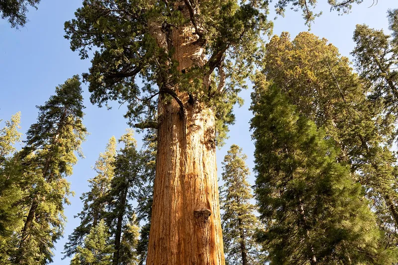
Photo: Eric Kilby from Somerville, MA, USA, CC BY-SA 2.0
#5 · Landmark · 1 hr 39 min east
General Sherman Tree
The largest tree on Earth by volume, reached by a short paved trail.
- 1-2 hrs
- Year-round
- See the official site for current fees
Heads-up: Shuttle in summer. Winter roads may need chains. Open; summer shuttle ended; trail icy in winter, bring traction devices
Plan my day
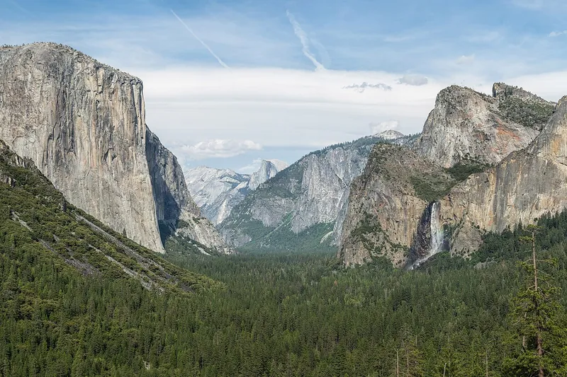
Photo: Diliff, CC BY-SA 3.0
#6 · Viewpoint · 1 hr 44 min north
Tunnel View
The classic first look at Yosemite Valley, with El Capitan, Bridalveil Fall and Half Dome in one frame. Pull off right on the way in.
- 30 min-1 hr
- Year-round
- See the official site for current fees
Heads-up: Parking lot fills at sunset. Check NPS conditions for chain controls in winter. Open year-round by road; short paved walk to the viewing area
Plan my day
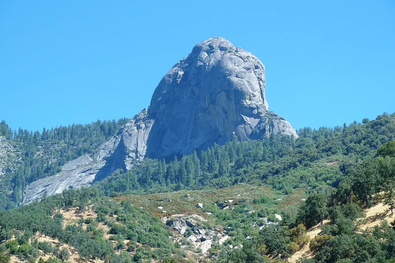
Photo: DiverDave, CC BY-SA 3.0
#7 · Hike · 1 hr 46 min east
Moro Rock
A short granite staircase climb to a sweeping view of the Great Western Divide.
- 1 hr
- Road usually open; winter closure possible
- See the official site for current fees
Heads-up: Stairs are steep. Road closes in snow. Crescent Meadow/Moro Rock road open now but not plowed; stairway closes when icy or snowy
Plan my day
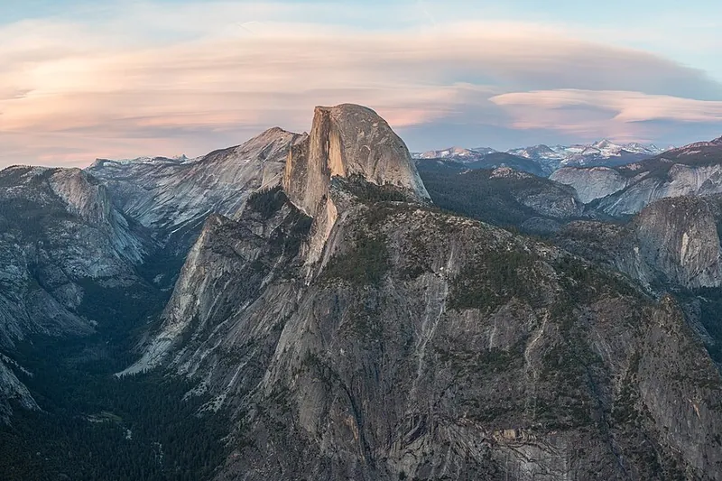
Photo: Diliff, CC BY-SA 3.0
#8 · Viewpoint · 2 hr 4 min north
Glacier Point
A big overlook 3,200 feet above the valley, facing Half Dome and Yosemite Falls. One of the best views in the Sierra.
- Half day
- Road usually open late May-Oct; closed in winter
- See the official site for current fees
Heads-up: Glacier Point Road is usually closed by November, so check NPS before you go. Glacier Point Road is closed for snow right now (seasonal, normally reopens late spring); Four Mile Trail is the only way…
Plan my day
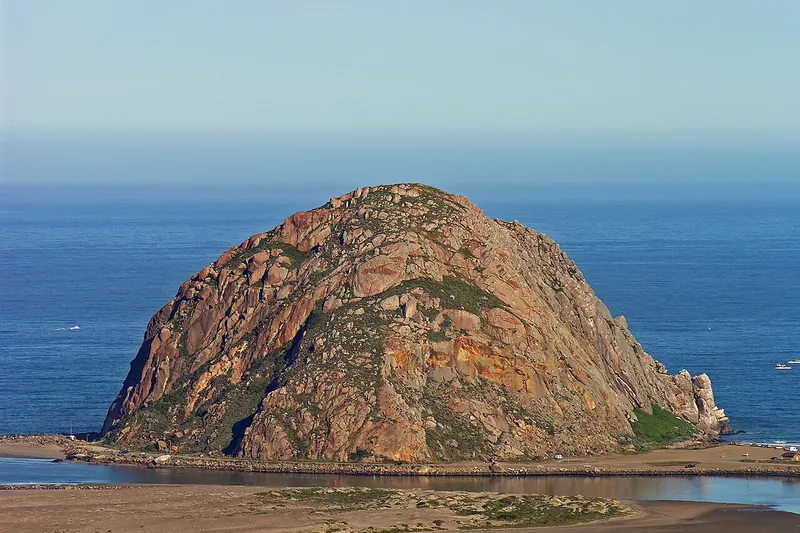
Photo: No machine-readable author provided. Kjkolb assumed (based on copyright claims)., CC BY 2.5
#9 · Landmark · 2 hr 30 min southwest
Morro Rock and Embarcadero
Sea-level volcanic plug beside a harbor with sea otters and kayak rentals.
Heads-up: Peregrine falcons nest on the rock, so no climbing.
Plan my day
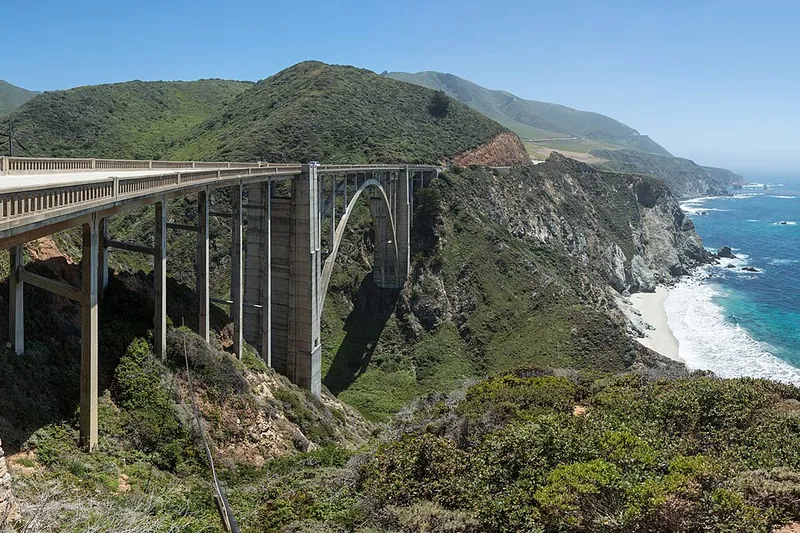
Photo: Diliff, CC BY-SA 3.0
#10 · Viewpoint · 2 hr 48 min west
Bixby Creek Bridge
Photo stop for the tall arched bridge on Highway 1 in Big Sur.
Heads-up: Parking is on the roadside. Check Highway 1 status. Highway 1 through Big Sur reopened Jan 2026; no-parking zone near the bridge since May 2026 (one year); check Caltrans for fire-related closures
Plan my day
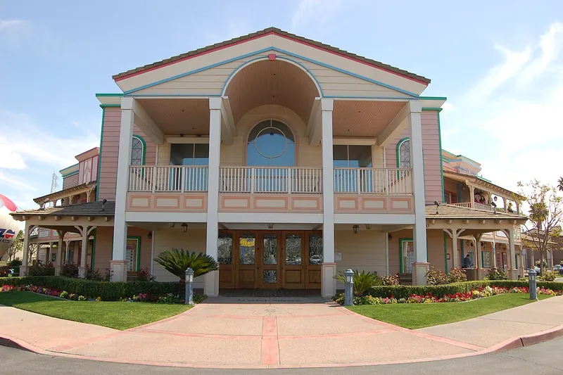
Photo: Skyman9999, CC0
#11 · Landmark · 1 hr 35 min southeast
Buck Owens Crystal Palace
A famous country music hall, restaurant and museum in Bakersfield with live music.
- 2-3 hrs
- Hours vary (confirm before you go)
- See the official site for current fees
Heads-up: Some shows are 21+.
Plan my day
Official site
#12 · Landmark · 1 hr 51 min north
El Capitan Meadow
Pull over and watch climbers on the granite face with binoculars. A flat walk by the Merced River.
- 30 min-1 hr
- Year-round
- See the official site for current fees
Heads-up: Stay on paths to protect the meadow. Open year-round; weekday 15 minute delays at El Capitan Bridge through Dec 2026
Plan my day
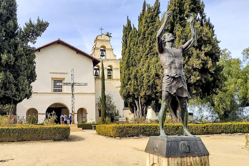
Photo: Dpalma01, CC BY-SA 4.0
#13 · Historic site · 1 hr 58 min west
Mission San Juan Bautista
Historic mission town with a plaza, old buildings and a wide valley view.
- 2-3 hrs
- Year-round
- See the official site for current fees
Heads-up: Town is in San Benito County. Check mission hours.
Plan my day
Official site
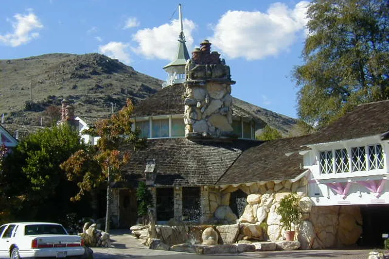
Photo: Original uploader was MCB (talk) at en.wikipedia, CC BY-SA 2.5
#14 · Landmark · 2 hr 23 min southwest
Madonna Inn
Eye-popping pink roadside inn, with a famous bakery.
- 1 hr
- Year-round
- Free to visit
Heads-up: Busy on weekends.
Plan my day
Official site
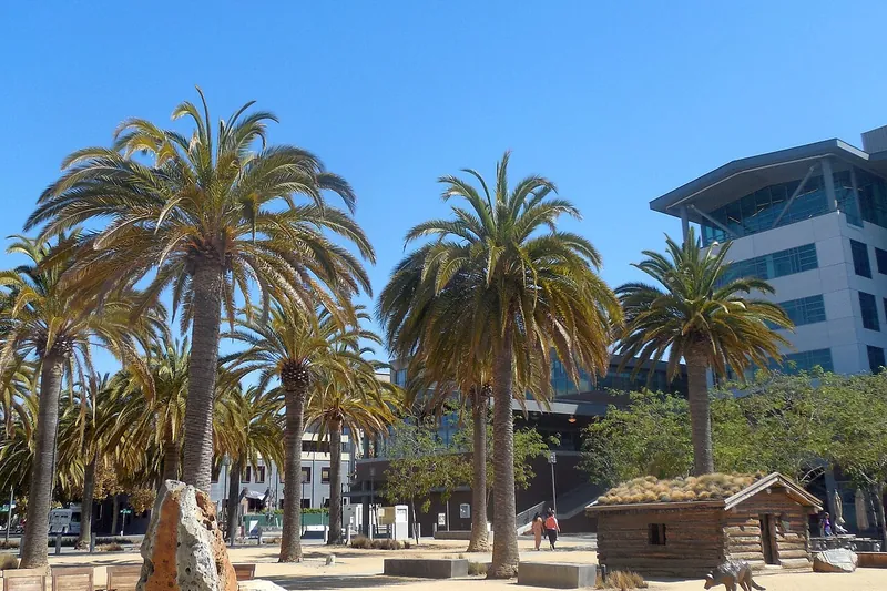
Photo: Niranjan Arminius, CC BY-SA 4.0
#15 · Landmark · 2 hr 44 min northwest
Jack London Square
A waterfront district in Oakland with restaurants, a Sunday farmers market and ferry views.
- 2-3 hrs
- Year-round
- Free to visit
Heads-up: Check market days.
Plan my day
Official site