Photo: Matthew Dillon from Hollywood, CA, USA, CC BY 2.0
#1 · Hike · 1 hr 38 min southwest
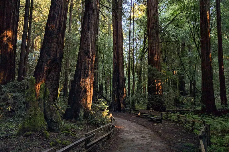
Muir Woods National Monument
Easy paths through old coast redwoods in a quiet canyon just north of the city.
- 2-3 hrs
- Year-round; best on weekdays
- See the official site for current fees
Heads-up: Parking or shuttle reservation required. Book ahead at the official site. No dogs. Little cell service.
Plan my day
Official site
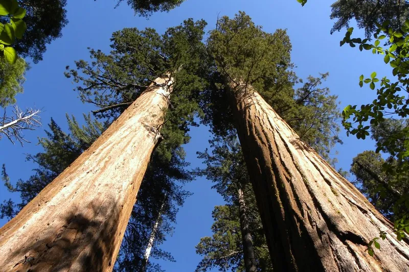
Photo: MARELBU, CC BY 3.0
#2 · State park · 2 hr 9 min east
Calaveras Big Trees State Park
Giant sequoias in the North Grove on an easy, mostly flat loop, where the big trees first became famous in the 1850s.
- 2-4 hrs
- Year-round (best May to October)
- California State Parks day-use fee (per vehicle)
Heads-up: The South Grove is closed now. The road past the North Grove closes at the first big snow or December 1.
Plan my day
Official site
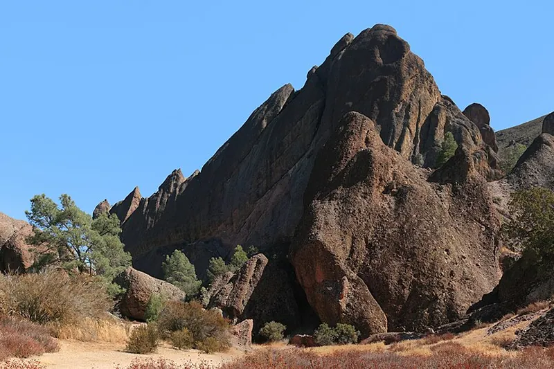
Photo: Brocken Inaglory, CC BY-SA 3.0
#3 · National park · 2 hr 58 min south
Pinnacles National Park
Spires and talus caves from an ancient volcano, plus condors and good hiking trails.
- Half day
- Year-round; best Oct-May
- See the official site for current fees
Heads-up: No road connects the east and west sides. Hot in summer. Dogs are only allowed in parking areas.
Plan my day
Official site
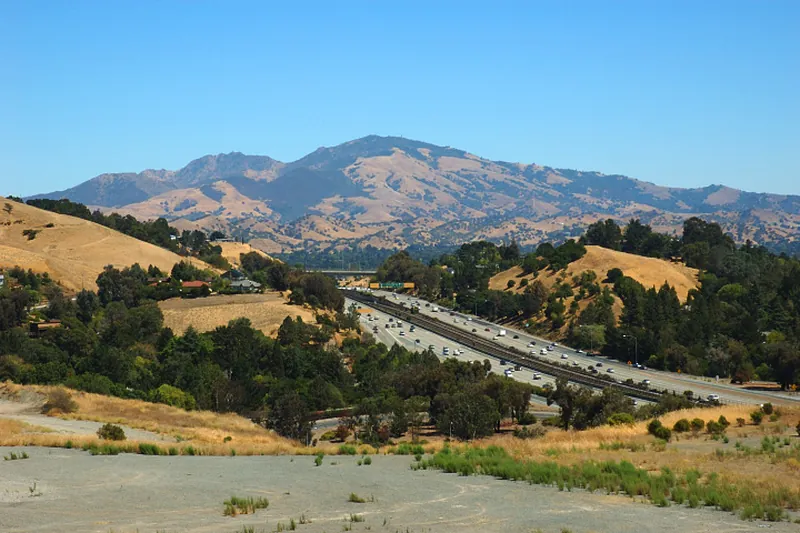
Photo: Trurl66, Public domain
#4 · State park · 1 hr 48 min southwest
Mount Diablo State Park
A tall peak in the East Bay with a summit road, wide views and many trails.
- Half day
- Year-round; spring wildflowers; summit views best on clear days
- See the official site for current fees
Heads-up: Hot in summer. Trails are steep. Dogs on leash in some areas only. Summit Visitor Center open daily 10-4 but its elevator is out of service with no repair date
Plan my day
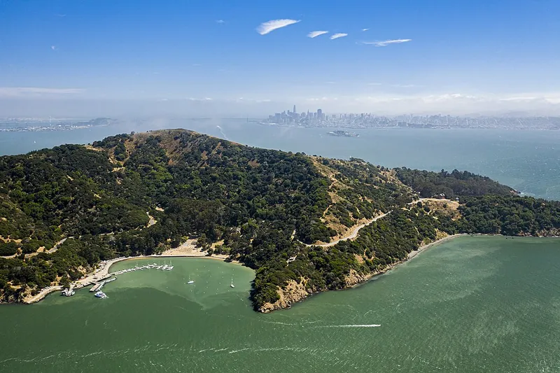
Photo: Taras Bobrovytsky, CC0
#5 · Island · 2 hr 17 min southwest
Angel Island State Park
Ferry to a bay island with a loop road, hiking, bike rentals and old military sites.
- Full day
- Year-round; reduced ferry in winter (confirm before you go)
- See the official site for current fees
Heads-up: Ferry needs advance tickets. No ferry on Thanksgiving or Christmas. Last boat leaves early afternoon in winter (confirm before you go).
Plan my day
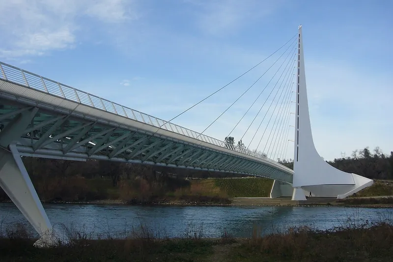
Photo: Chad K, CC BY 2.0
#6 · Landmark · 2 hr 22 min north
Sundial Bridge
A glass-decked footbridge over the Sacramento River in Redding that works as a giant sundial, linked to miles of river trails.
Heads-up: The bridge and trails are always open; summer afternoons are very hot.
Plan my day
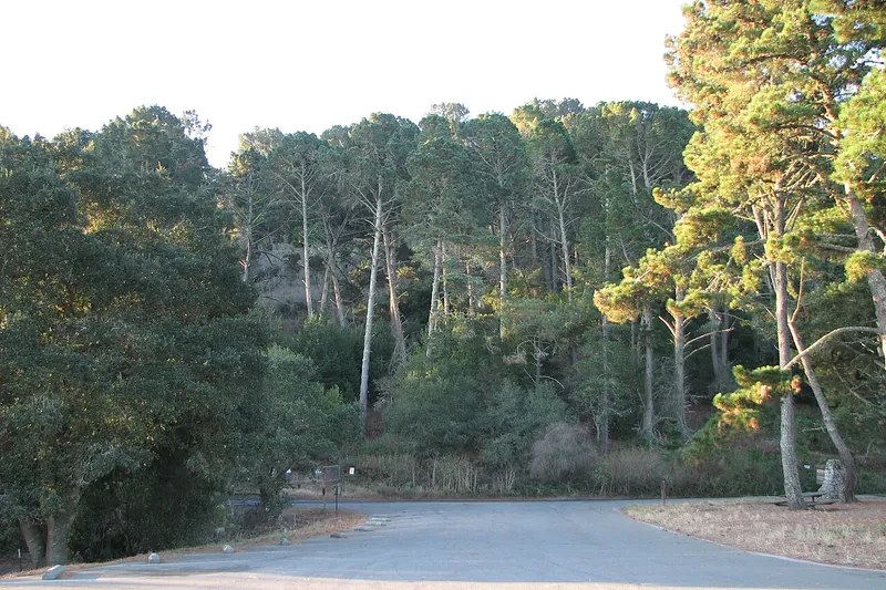
Photo: Ijon, CC BY-SA 4.0
#7 · Hike · 1 hr 21 min southwest
Tilden Regional Park
A park in the Berkeley hills with trails, a lake, a carousel and a small steam train.
- 2-4 hrs
- Year-round
- See the official site for current fees
Heads-up: Swimming at Lake Anza costs money in summer (confirm before you go). Open 5am-10pm; Lake Anza swim beach closed for the season
Plan my day
Official site
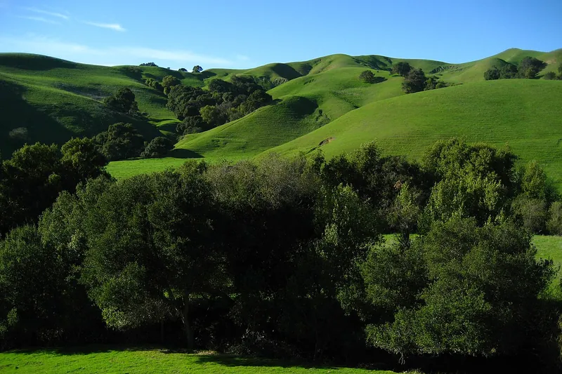
Photo: No machine-readable author provided. Mrbilal1987~commonswiki assumed (based on…, Public domain
#8 · Hike · 1 hr 22 min southwest
Briones Regional Park
Rolling hills with oak woodlands, wildflowers and wide views in Contra Costa County.
- 2-4 hrs
- Year-round; best in spring
- See the official site for current fees
Heads-up: Cattle graze here. Hot in late summer.
Plan my day
Official site
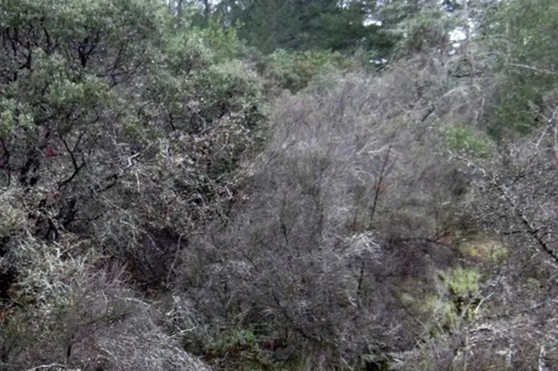
Photo: Logan Ingalls, CC BY 3.0
#9 · State park · 1 hr 22 min west
Bothe-Napa Valley State Park
Redwood trails, a pool and picnic areas near Calistoga.
- 2-4 hrs
- Year-round; pool in summer (confirm before you go)
- See the official site for current fees
Heads-up: Hot in summer. Open 8am to sunset; pool weekends only 1-5pm in season
Plan my day
Official site
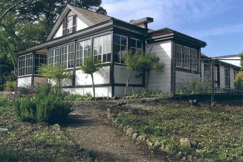
Photo: Robert E. Nylund, Public domain
#10 · State park · 1 hr 27 min west
Jack London State Historic Park
An author's old ranch with trails, a cottage and a small museum in Glen Ellen.
- 2-4 hrs
- Closed some weekdays (confirm before you go)
- See the official site for current fees
Heads-up: Some buildings may have limited hours.
Plan my day
Official site
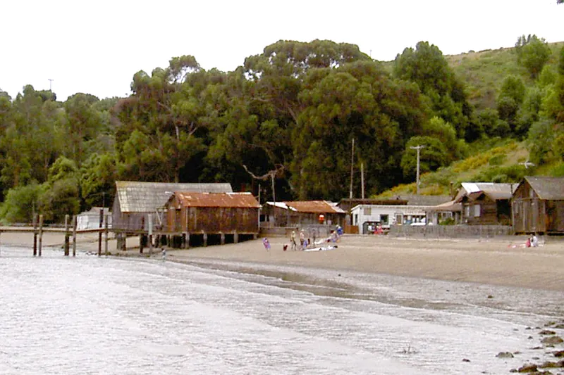
Photo: Stepheng3, Public domain
#11 · State park · 1 hr 30 min southwest
China Camp State Park
A San Rafael bayside park with shoreline trails, a historic fishing village and biking.
- 2-4 hrs
- Year-round
- See the official site for current fees
Heads-up: Hot in summer. Few services.
Plan my day
Official site
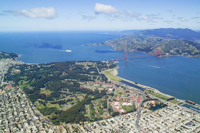
Photo: Robert Campbell, CC BY-SA 3.0
#12 · Historic site · 1 hr 34 min southwest
Presidio of San Francisco
A former army post turned park with trails, gardens, beaches and a visitor center.
Heads-up: Plan a route. Free shuttle runs in the park (confirm before you go).
Plan my day
Official site
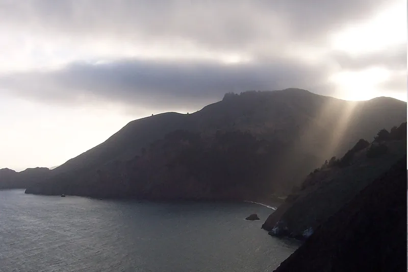
Photo: Christopher Beland, Public domain
#13 · Hike · 1 hr 40 min southwest
Marin Headlands and Point Bonita Lighthouse
Old gun batteries, bay views, and a short bridge walk to a lighthouse on a rocky point.
- 2-4 hrs
- Year-round; lighthouse open on set days only (confirm before you go)
- See the official site for current fees
Heads-up: Check lighthouse bridge hours. Winds and fog. Park closures possible. Point Bonita trail open only 3rd Saturday of month 12:30-3:30; suspension bridge to lighthouse closed until further notice; rest…
Plan my day
Official site
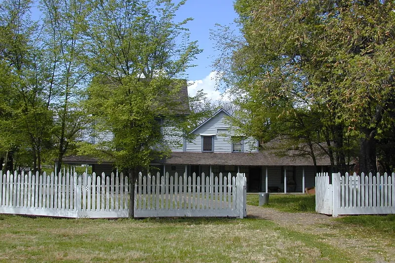
Photo: Anderson Marsh State Historic Park Staff, Public domain
#14 · State park · 1 hr 42 min west
Anderson Marsh State Historic Park
Wetlands and old ranch trails near Clear Lake with birds and short walks.
- 1-3 hrs
- Year-round
- See the official site for current fees
Heads-up: Mosquitoes in warm months. Monthly guided nature walks 2nd Saturday (not Jan/Dec)
Plan my day
Official site
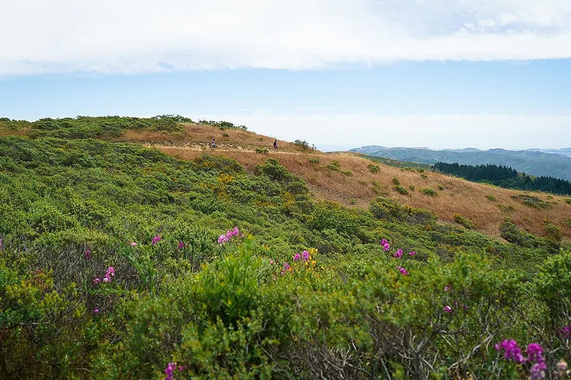
Photo: Oscar Vasquez / California Department of Parks and Recreation, Public domain
#15 · State park · 1 hr 49 min southwest
Mount Tamalpais State Park
Marin's tall peak with redwood canyons, ocean views and summit hikes.
- Half day
- Year-round; fog rolls in often
- See the official site for current fees
Heads-up: Roads are narrow. Summit trails are steep. Dogs are limited to some trails. Matt Davis Spur Trail permanently closed; main park open; fees at East Peak, Pantoll, Bootjack
Plan my day
Official site