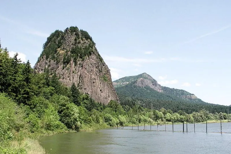
Photo: U.S. Geological Survey, Public domain
#1 · State park · 52 min east
Beacon Rock State Park
A switchback trail up a huge rock core over the Columbia River.
- 2 hrs
- Year-round
- Discover Pass
Heads-up: Rails and drop-offs; hold onto kids.
Day Trippin' › Oregon › From Portland › Best hikes
Our picks for the best hikes within 3 hours of Portland: 48 places, 9 under an hour away, 24 between 1 and 2 hours and 15 between 2 and 3 hours, counted by road time from ZIP 97205.
We put first the places with a real photo, a well-known name, a family-friendly note and an official site, then list the rest by drive time. The closest is Oregon City and Willamette Falls, 26 min south of Portland.
Under 1 hour 1 to 2 hours 2 to 3 hours
Photo: U.S. Geological Survey, Public domain
#1 · State park · 52 min east
A switchback trail up a huge rock core over the Columbia River.
Heads-up: Rails and drop-offs; hold onto kids.
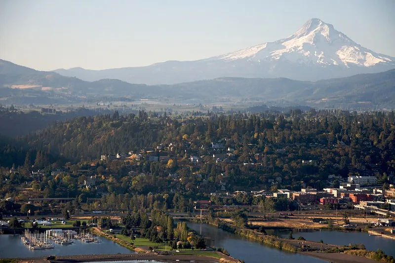
Photo: Sam Beebe, CC BY 2.0
#2 · Farm · 1 hr 5 min east
Orchards, farm stands, cideries and wineries with Mount Hood in view.
Heads-up: Bring a designated driver for tastings.
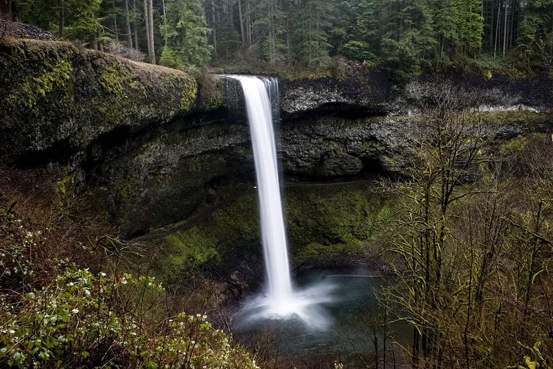
Photo: Kelvin Kay -- Kkmd at English Wikipedia, CC BY-SA 3.0
#3 · State park · 1 hr 17 min south
The Trail of Ten Falls, including a path behind 177-foot South Falls.
Heads-up: Dogs aren't allowed on the Canyon Trail (the Trail of Ten Falls loop below the rim) or the Maple Ridge, Winter Falls and Twin Falls trails.
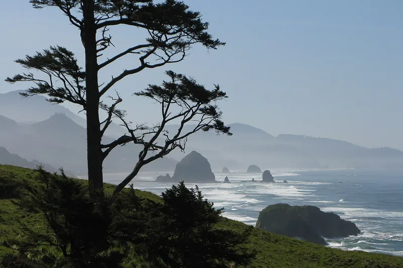
Photo: Brmuchim (talk), CC BY-SA 3.0
#4 · State park · 1 hr 34 min northwest
Forested headland trails with big views of the coast and Haystack Rock, plus Indian Beach for surfers.
Heads-up: Landslides have closed parts of the park before; the west section of the Clatsop Loop Trail has been closed since April 2026 by an active slide. Check the park page before you go.
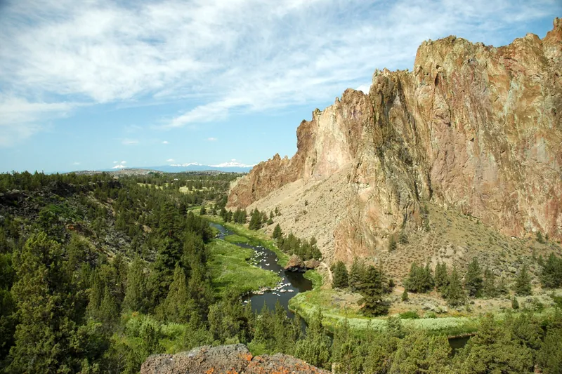
Photo: Ennetws, Public domain
#5 · State park · 2 hr 52 min southeast
Towering rock walls above the Crooked River, a top climbing spot with river trails for everyone.
Heads-up: Misery Ridge is steep and exposed; the River Trail is easy. Construction closes some trails and parking Dec 2026-May 2027.
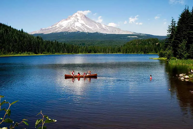
Photo: Unknown, CC BY-SA 3.0
#6 · Lake · 1 hr 18 min east
A small lake with the classic reflection of Mount Hood and an easy loop trail.
Heads-up: In winter the road isn't open to the lake. Park at Trillium Sno-Park on Hwy 26 and ski or snowshoe in (about 4.4 miles round trip).
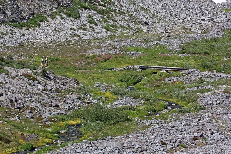
Photo: Walter Siegmund (talk), CC BY-SA 3.0
#7 · Viewpoint · 2 hr 51 min northeast
Wildflower meadows and glaciers on Mount Rainier's south side, with a visitor center.
Heads-up: No timed entry in 2026; summer weekend lots fill by late morning.
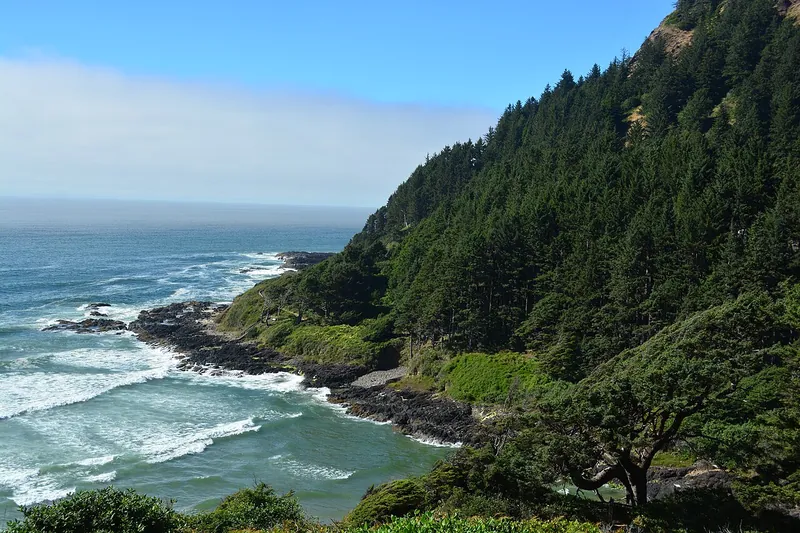
Photo: Joe Mabel, CC BY-SA 4.0
#8 · Viewpoint · 2 hr 54 min southwest
Thor's Well, the Spouting Horn and a stone shelter view from the highest point on the coast road.
Heads-up: Stay well back from Thor's Well; sneaker waves are deadly.
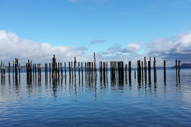
Photo: Jennifer Snoek-Brown, CC BY-SA 4.0
#9 · Waterfront · 2 hr 22 min north
Tacoma's waterfront promenade: a flat, paved path along Commencement Bay past little beaches, old pier pilings and Mount Rainier views, ending at Point Ruston's plaza of restaurants, ice cream and shops next to Point Defiance.
Heads-up: Free parking along Ruston Way fills fast on sunny weekends; at Point Ruston, check the posted parking rules (shops validate). Dogs on leash. In summer, give seal pups on the beaches plenty of room.
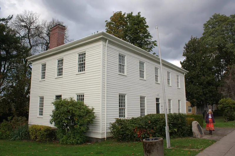
Photo: Pete Forsyth, CC BY 4.0
#10 · History · 26 min south
The end of the Oregon Trail, a free municipal elevator and a view of the big Willamette Falls.
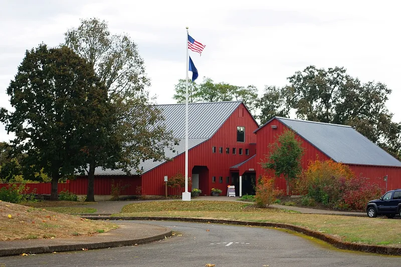
Photo: M.O. Stevens, CC BY-SA 3.0
#11 · History · 32 min southwest
Where Oregon's first government was voted in, with river trails and bike paths.
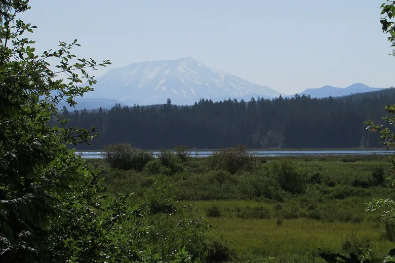
Photo: Chris Light, CC BY-SA 4.0
#12 · Museum · 1 hr 2 min north
Exhibits on the eruption, plus a lakeside wetland trail.
Heads-up: Open Wednesday-Sunday only from November to March.
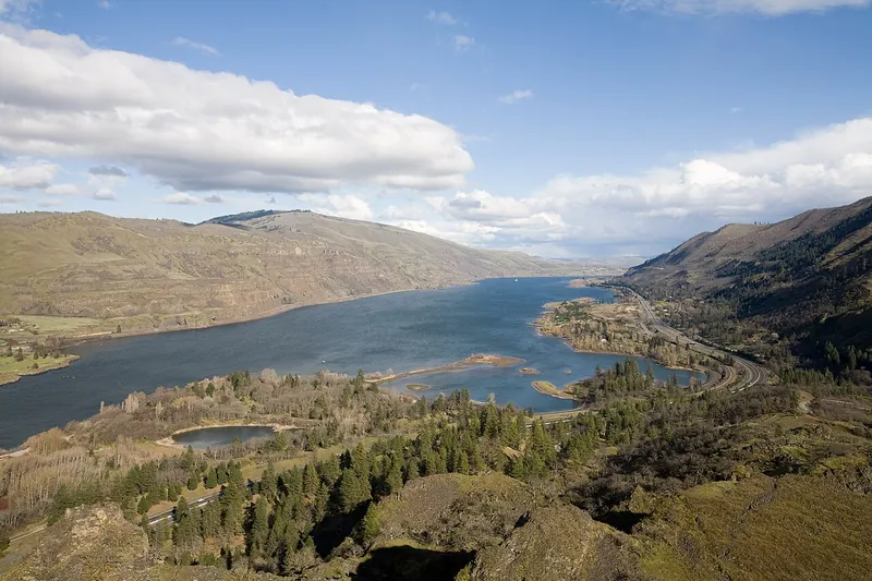
Photo: Cacophony, CC BY 3.0
#13 · Viewpoint · 1 hr 16 min east
A loop road and plateau with spring wildflowers above the eastern Gorge.
Heads-up: Ticks and poison oak, so stay on trails. Dogs aren't allowed on the Tom McCall Preserve trails, and there are no restrooms at the crest (they're at lower Mayer).
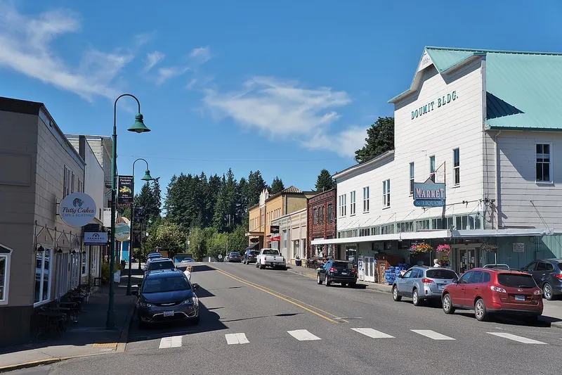
Photo: SounderBruce, CC BY-SA 4.0
#14 · Town · 1 hr 20 min northwest
A quiet river town and a flat island loop, linked to Oregon by a tiny ferry.
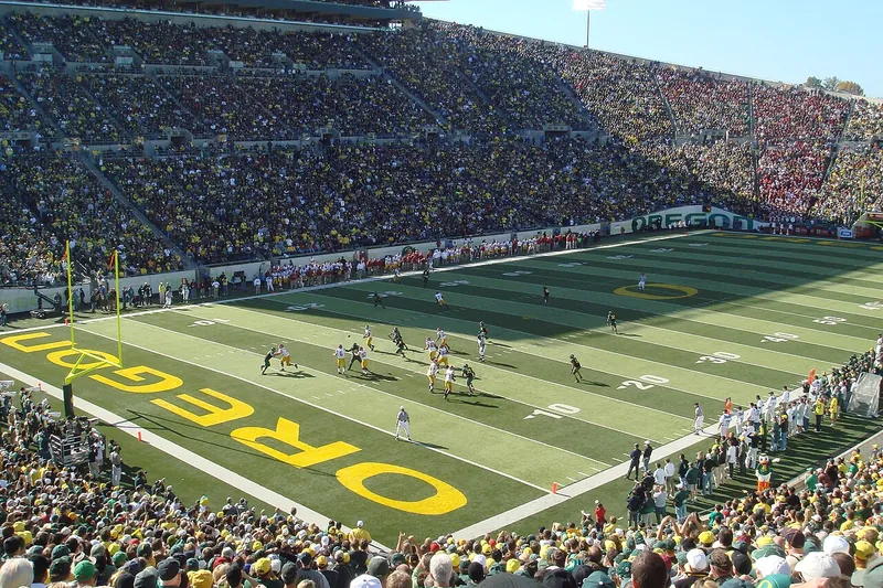
Photo: Bobak Ha'Eri, CC BY 3.0
#15 · Town · 1 hr 49 min south
A college town with the Saturday Market, riverside trails and Skinner Butte.
Bridal Veil Falls (Oregon) (32 min), Wahkeena and Multnomah loop (35 min), Oneonta Gorge and Horsetail Falls (39 min), Cape Horn Trail (39 min), Eagle Creek and Punch Bowl Falls (47 min), Wahclella Falls (50 min), Dog Mountain (1 hr 3 min), Mosier Twin Tunnels (1 hr 8 min), Mirror Lake (Mount Hood) (1 hr 9 min), Silver Star Mountain (1 hr 15 min), Ape Cave (1 hr 16 min), Ramona Falls (1 hr 22 min), Saddle Mountain (1 hr 24 min), Catherine Creek (1 hr 28 min), Three Capes Scenic Route (1 hr 30 min), Tamanawas Falls (1 hr 33 min), Cape Lookout State Park (1 hr 36 min), Neahkahnie Mountain (1 hr 39 min), Tumwater Falls Park (1 hr 43 min), Lost Lake (Hood River County) (1 hr 45 min), Lewis River Falls (1 hr 53 min), Drift Creek Falls (1 hr 54 min), Carbon River (2 hr 24 min), McKenzie River Trail and Sahalie Falls (2 hr 29 min), Longmire (2 hr 32 min), Tamolitch Blue Pool (2 hr 34 min), Silver Falls (Ohanapecosh) (2 hr 38 min), Comet Falls (2 hr 39 min), Staircase (Olympic National Park) (2 hr 51 min), Proxy Falls (2 hr 56 min), Sweet Creek Falls (2 hr 57 min), Twin Falls (2 hr 59 min), Little Si (3 hr)
Our top picks are Beacon Rock State Park (52 min), Hood River and the Fruit Loop (1 hr 5 min), Silver Falls State Park (1 hr 17 min), Ecola State Park (1 hr 34 min) and Smith Rock State Park (2 hr 52 min). The page lists 48 places in all.
48: 9 under an hour away, 24 between 1 and 2 hours and 15 between 2 and 3 hours, by road from ZIP 97205.
Oregon City and Willamette Falls, about 26 min south of Portland.
14 need no pass or fee, including Bridal Veil Falls (Oregon), Hood River and the Fruit Loop and Oneonta Gorge and Horsetail Falls. Fees change, so check each place.
28 of the 48 list themselves as open year-round. Places with a season say so on their card; check hours before you go.

Drive times are by road on a typical day from ZIP <class 'zip'> (OpenStreetMap data with the OSRM route planner); places under 25 minutes away count as in town. Facts checked against official sites; passes and hours change, so check before you go.