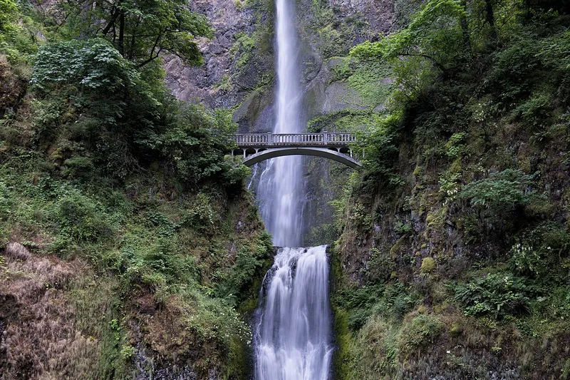
Photo: John Fowler from Placitas, NM, USA, CC BY 2.0
#1 · Waterfall · 36 min east
Multnomah Falls
Oregon's tallest waterfall, 620 feet in two tiers, with a bridge across the middle.
- 1 hr
- Year-round
- Timed-use permit for the I-84 lot in summer (2026: May 22-Sept 7, 9 am-6 pm)
Heads-up: The I-84 lot at Exit 31 fills fast. In summer, book a timed-use permit ahead on Recreation.gov (none sold on site). No permit was needed on the Historic Highway in 2026. Lodge restrooms are closed…
Plan my day
Official site
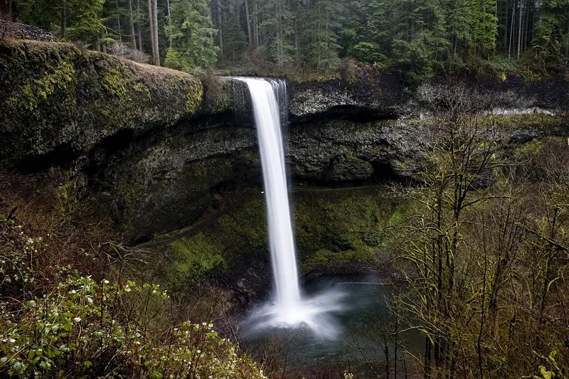
Photo: Kelvin Kay -- Kkmd at English Wikipedia, CC BY-SA 3.0
#2 · State park · 1 hr 17 min south
Silver Falls State Park
The Trail of Ten Falls, including a path behind 177-foot South Falls.
- Half day
- Year-round
- Oregon State Parks day-use parking permit
Heads-up: Dogs aren't allowed on the Canyon Trail (the Trail of Ten Falls loop below the rim) or the Maple Ridge, Winter Falls and Twin Falls trails.
Plan my day
Official site
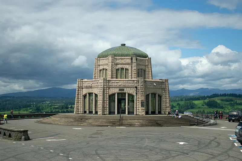
Photo: Josh B, CC BY-SA 2.0
#3 · Viewpoint · 30 min east
Vista House and Crown Point
A stone observatory high above the Columbia River at the start of the waterfall road.
- 1 hr
- Year-round
- No pass or fee needed
Heads-up: It's one of the windiest spots in the Gorge.
Plan my day
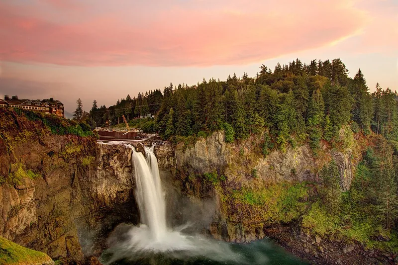
Photo: Meher Anand Kasam, CC BY-SA 3.0
#4 · Waterfall · 2 hr 56 min north
Snoqualmie Falls
A 268-foot falls with an overlook a short walk from the parking lot.
- 1 hr
- Year-round
- Free upper lot (cross the sky bridge); the lower lot charges for parking
Heads-up: Lower trail is steep.
Plan my day
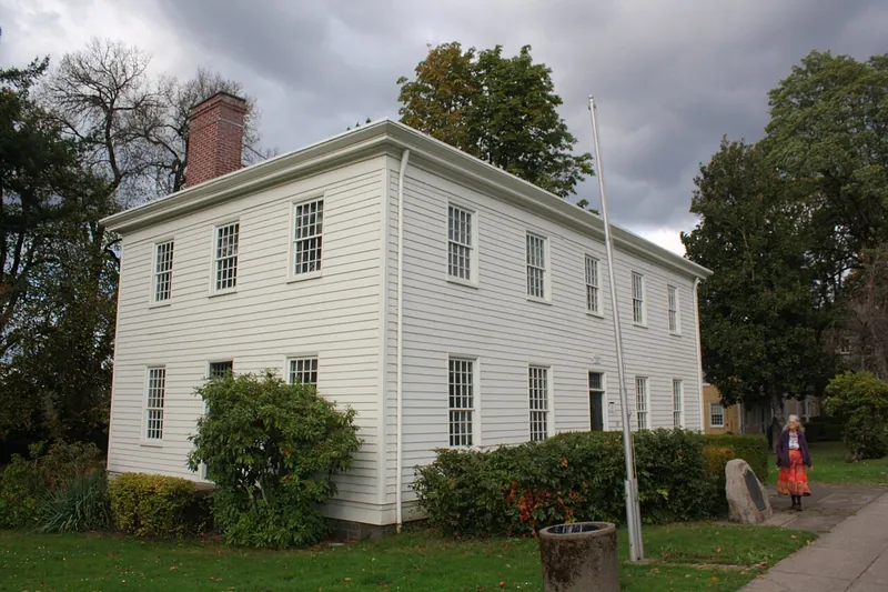
Photo: Pete Forsyth, CC BY 4.0
#5 · History · 26 min south
Oregon City and Willamette Falls
The end of the Oregon Trail, a free municipal elevator and a view of the big Willamette Falls.
- 2-3 hrs
- Year-round
- Museum admission
Plan my day
Official site
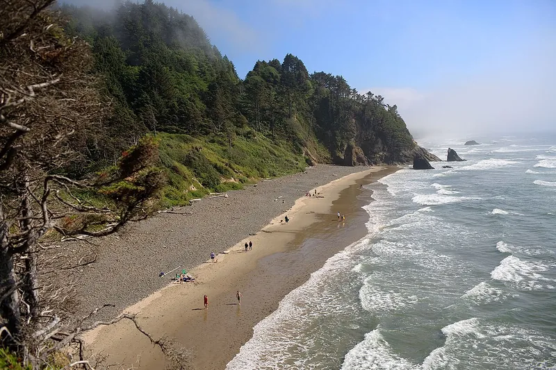
Photo: Curt Smith from Bellevue, WA, USA, CC BY 2.0
#6 · Beach · 1 hr 32 min west
Hug Point
A beach with a waterfall, sea caves and an old wagon road cut into the rock.
- 1-2 hrs
- Year-round
- No pass or fee needed
Heads-up: Only walk around the point at low tide; the tide comes in fast.
Plan my day
Official site
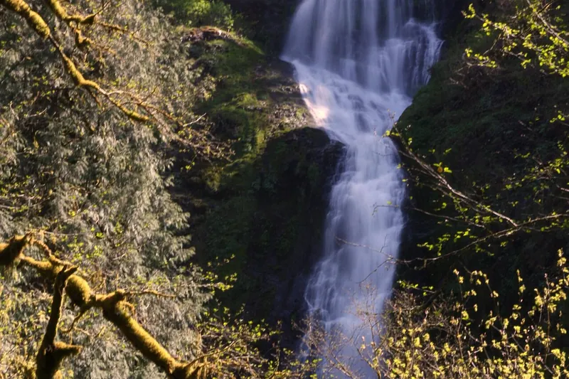
Photo: brx0, CC BY-SA 2.0
#7 · Waterfall · 1 hr 34 min west
Munson Creek Falls
The tallest waterfall in the Coast Range, a short walk from the parking area.
- 1 hr
- Year-round
- No pass or fee needed
Heads-up: The access road is narrow; no trailers.
Plan my day
Official site
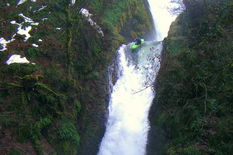
Photo: SarahMcD, CC BY 2.0
#8 · Waterfall · 32 min east
Bridal Veil Falls (Oregon)
A short trail down to a two-step falls in the Gorge.
- 1 hr
- Year-round
- No pass or fee needed
Plan my day
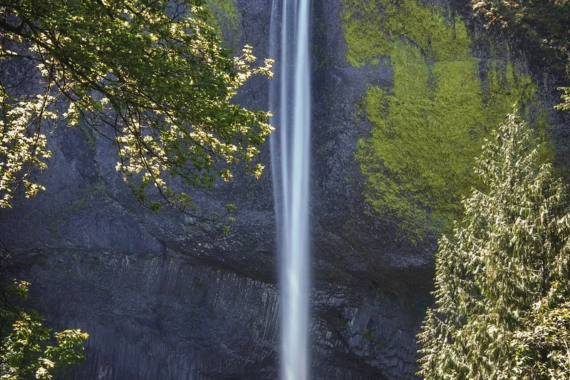
Photo: Steven Pavlov, CC BY-SA 4.0
#9 · Waterfall · 33 min east
Latourell Falls
A short walk to a falls dropping over yellow-green lichen-covered basalt.
- 1 hr
- Year-round
- Oregon State Parks day-use parking permit
Heads-up: Parking now needs a state parks day-use permit (new in spring 2026).
Plan my day
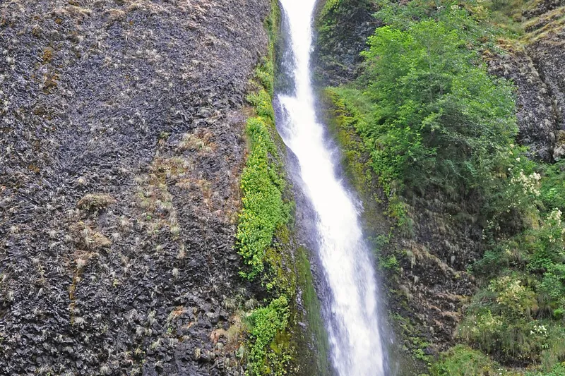
Photo: James St. John, CC BY 2.0
#10 · Waterfall · 39 min east
Oneonta Gorge and Horsetail Falls
Horsetail Falls right by the road, and a trail behind Ponytail Falls.
- 1-2 hrs
- Year-round
- No pass or fee needed
Heads-up: Oneonta Gorge (the creek-bed scramble) is closed by a Forest Service order. The Horsetail and Oneonta trails are open but have steep cliffs in places, and a bridge farther up the Oneonta Trail was…
Plan my day
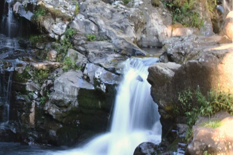
Photo: PJ Blalock, Public domain
#11 · Waterfall · 44 min northeast
Moulton Falls
A tall arch bridge over the East Fork Lewis River, with swimming holes.
- 1-2 hrs
- Year-round
- No pass or fee needed
Heads-up: Cold, fast water.
Plan my day
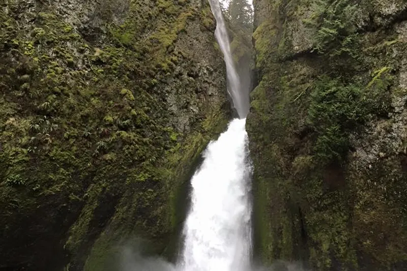
Photo: Max Benbassat, CC BY-SA 4.0
#12 · Trail · 50 min east
Wahclella Falls
A short canyon hike to a two-tier falls in a mossy box canyon.
- 1-2 hrs
- Year-round
- NW Forest Pass or day-use fee
Heads-up: Avoid it during or within 48 hours of heavy rain or snow, because flash floods and slides are still a risk after the 2017 fire. No cash at the trailhead, so buy a pass ahead or pay by QR code.
Plan my day
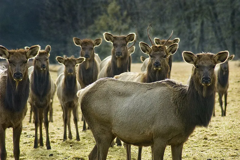
Photo: Oregon Department of Fish & Wildlife, CC BY-SA 2.0
#13 · Wildlife · 1 hr 10 min northwest
Jewell Meadows Wildlife Area
Roosevelt elk graze in the meadows, best seen in fall and winter.
- 1 hr
- Late fall-spring
- Wildlife area parking permit
Heads-up: The main meadow is closed to the public; watch from the viewing areas. Winter elk feeding tours need a reservation.
Plan my day
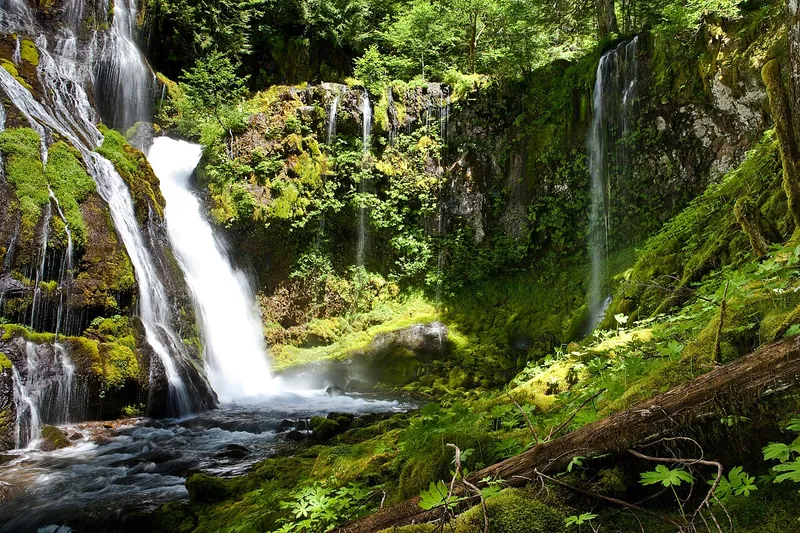
Photo: Matthew P. Del Buono, CC BY-SA 3.0
#14 · Waterfall · 1 hr 17 min northeast
Panther Creek Falls
A lacy falls viewed from a platform after a short walk.
- 30 min
- Spring-fall
- Day pass on Recreation.gov, or a NW Forest Pass
Plan my day
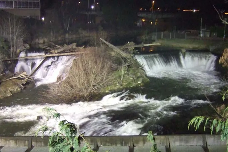
Photo: Sundodger at en.wikipedia, Public domain
#15 · Waterfall · 1 hr 43 min north
Tumwater Falls Park
A short loop past a series of falls on the Deschutes River, with salmon in the fall.
- 1 hr
- Year-round; salmon Sept-Oct
- No pass or fee needed
Heads-up: Open 8 am to 8 pm; the entry gate closes at 7:30 pm.
Plan my day