Photo: Lee Adlaf from Birmingham, AL, USA, CC BY 2.0
#1 · Canyon · 27 min northeast
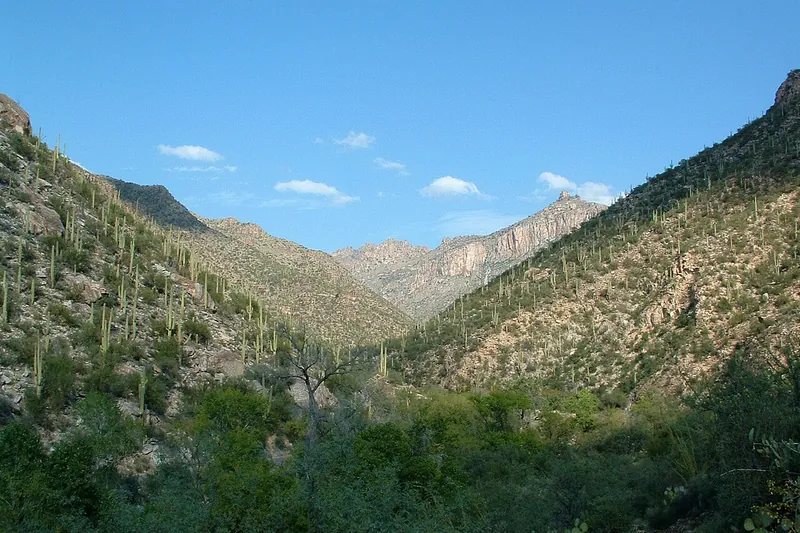
Sabino Canyon Recreation Area
A green desert canyon with a creek, pools and saguaro slopes. Ride the narrated shuttle up the canyon road, then walk back down or hike from the top stops.
- Half day
- Best October to April; summer mornings only
- Coronado day-use fee (per vehicle) or America the Beautiful pass; shuttle ticket extra
Heads-up: The Sabino Canyon Crawler shuttle was suspended on November 2, 2026 after flooding, so check before you go. No dogs anywhere in the area (service animals are OK).
Plan my day
Official site
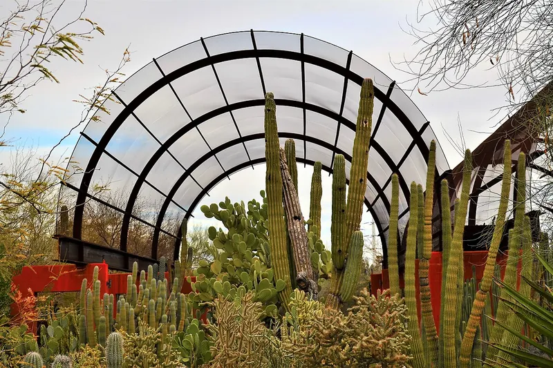
Photo: Scotwriter21, CC BY-SA 4.0
#2 · Garden · 1 hr 40 min northwest
Desert Botanical Garden
Thousands of desert plants along garden trails in Papago Park, beautiful in spring bloom.
- 2-3 hrs
- Year-round
- Admission
Heads-up: Summer is very hot; go early. No pets except on special Dogs in the Garden days.
Plan my day
Official site
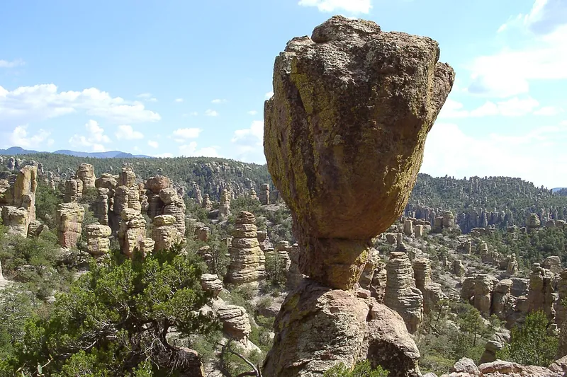
Photo: Pretzelpaws, CC BY-SA 3.0
#3 · National park · 1 hr 51 min east
Chiricahua National Park
Drive Bonita Canyon up to Massai Point and look out over a forest of stone spires, then hike down among them on the Echo Canyon trail. America's newest national park (October 2026).
- Half day
- Year-round; best spring and fall; snow and ice possible November to April
- Free (no entrance fee)
Heads-up: Vehicles over 24 ft can't drive past the campground, and the nearest gas and food are 30-40 miles away. The hiker shuttle isn't running, and dogs are allowed only on the lower trails, not at Massai…
Plan my day
Official site
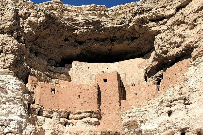
Photo: Beyond My Ken, CC BY-SA 4.0
#4 · National monument · 3 hr north
Montezuma Castle National Monument
A five-story Sinagua cliff dwelling tucked in a limestone cliff above Beaver Creek.
- 1 hr
- Year-round
- NPS entrance fee (same pass covers Tuzigoot)
Heads-up: Leashed pets are fine on the trail but not in the visitor center.
Plan my day
Official site
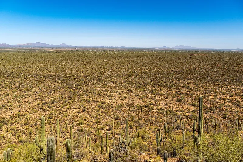
Photo: dconvertini, CC BY-SA 2.0
#5 · National park · 27 min west
Saguaro National Park West
The graded dirt Bajada Loop runs through some of the thickest saguaro forest anywhere, with a short climb at Signal Hill to boulders covered in ancient Hohokam rock carvings.
- 2-3 hrs
- Best October to April; summer mornings only
- NPS entrance fee (per vehicle, 7 days, covers both districts) or America the Beautiful pass
Heads-up: The Bajada Loop is unpaved but fine for regular cars, and closes to vehicles from dusk to dawn. Dogs can go on the loop road and the paved Desert Discovery Trail, but not on the Signal Hill path.
Plan my day
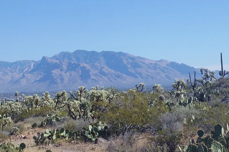
Photo: WClarke, CC BY-SA 4.0
#6 · Scenic drive · 1 hr 18 min northeast
Mount Lemmon and the Catalina Highway
Climb from saguaro desert to pine forest in about an hour, with big viewpoints like Windy Point on the way up and pie and cabins in tiny Summerhaven near the top.
- Half day to full day
- Year-round; summer escape from the heat; winter can bring snow
- Free to drive; Coronado day-use fee (per vehicle) or America the Beautiful pass at fee picnic areas and trailheads
Heads-up: The road is narrow and curvy, and it can close or require chains in storms; check the Pima County Sheriff road line before winter trips. It is about 25 degrees cooler on top, so bring layers.
Plan my day

Photo: DESI Collaboration/DOE/KPNO/NOIRLab/NSF/AURA/L. Tyas, CC BY 4.0
#7 · Observatory · 1 hr 5 min southwest
Kitt Peak National Observatory
Drive up to a 6,800-foot mountaintop full of giant telescope domes, take a guided telescope tour, or come back after dark for a stargazing program.
- Half day
- Year-round; snow and ice possible in winter
- Free visitor center; tours and night programs need paid reservations
Heads-up: The last 12 miles are a winding mountain road with no services, and the summit is much cooler than Tucson. Book tours ahead; groups are small.
Plan my day
Official site
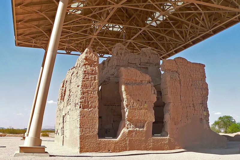
Photo: Greg Hume, CC BY-SA 3.0
#8 · National monument · 1 hr 8 min northwest
Casa Grande Ruins National Monument
See the four-story adobe Great House that Ancestral Sonoran Desert People built about 700 years ago, now under a large protective roof.
- 1-2 hrs
- Best October to April; open year-round
- Free
Heads-up: Open 9 a.m. to 4 p.m. (gate closes about 3:45) and closed on four holidays.
Plan my day
Official site
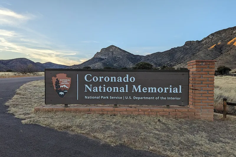
Photo: Alb2001, CC BY-SA 4.0
#9 · Viewpoint · 1 hr 37 min southeast
Coronado National Memorial
Drive up to Montezuma Pass for wide views over the San Rafael Valley into Mexico, and walk the short trail up Coronado Peak.
- 2-3 hrs
- Year-round; summer storms in the afternoon
- Free
Heads-up: The road to Montezuma Pass turns to steep graded dirt after the first mile; vehicles over 24 ft can't go past the visitor center, and the road can close after heavy rain or snow.
Plan my day
Official site
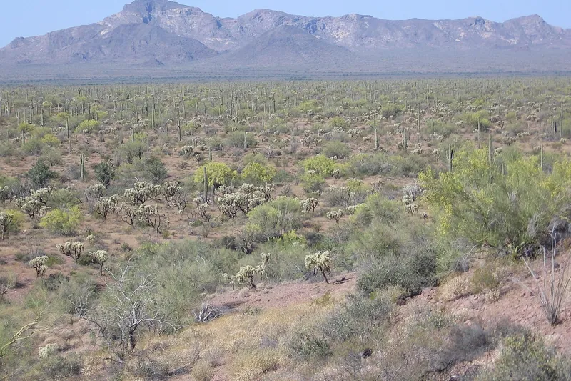
Photo: Klaus Eltrop, CC BY-SA 3.0
#10 · National monument · 2 hr 20 min west
Organ Pipe Cactus National Monument
Remote Sonoran Desert where many-armed organ pipe cactus grow wild, explored on long scenic dirt drives, through the old copper town of Ajo on the way.
- Full day
- Best November to March
- NPS entrance fee (per vehicle, 7 days) or America the Beautiful pass
Heads-up: A long drive with unpaved scenic roads. Roads near the border have been closed since August 24, 2026; check conditions. Dogs only on three short trails and the roads.
Plan my day
Official site
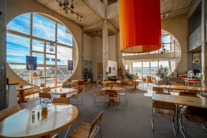
Photo: Elitemedia.network, CC BY-SA 4.0
#11 · Landmark · 2 hr 40 min northwest
Arcosanti
An experimental desert town of concrete domes and arches, famous for its bronze and ceramic wind bells.
- 1-2 hrs
- Year-round
- Guided tour fee
Heads-up: Visits are by guided tour; book ahead. Many spots are reached only by stairs. Leashed dogs OK on the grounds. The café is closed for now.
Plan my day
Official site
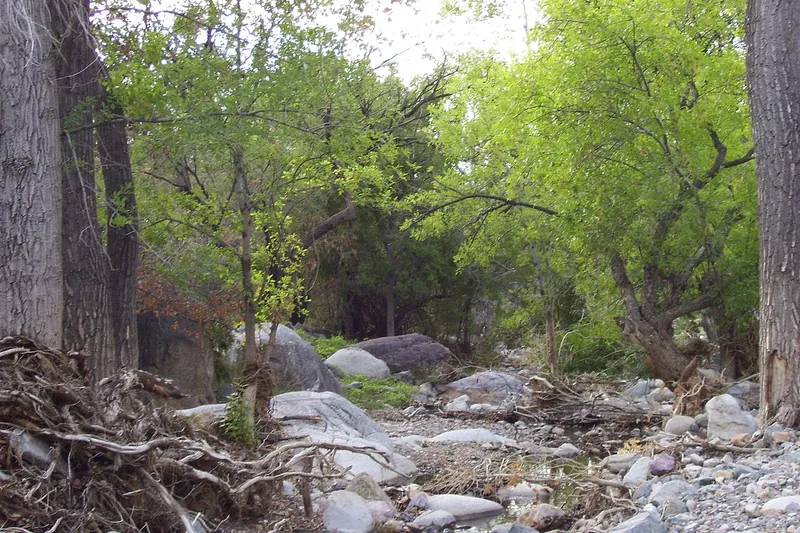
Photo: $1LENCE D00600D, CC BY-SA 3.0
#12 · Canyon · 59 min south
Madera Canyon
A cool, wooded canyon in the Santa Rita Mountains, famous with birders for hummingbirds and trogons, with easy creekside walks and tough climbs toward Mount Wrightson.
- Half day
- Year-round; spring and summer for birds
- Coronado day-use fee (per vehicle) or America the Beautiful pass
Heads-up: Day use is 6 a.m. to 10 p.m. Fee stations take exact cash or check, or buy a pass on Recreation.gov ahead. The Whitehouse trail is paved.
Plan my day
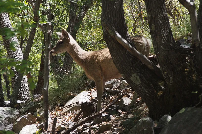
Photo: Clay Gilliland, CC BY-SA 2.0
#13 · Wildlife · 1 hr 26 min southeast
Ramsey Canyon Preserve
A shady, cool creek canyon in the Huachucas, known for hummingbirds and rare birds, with an easy creekside path and a steeper climb to an overlook.
- 2-3 hrs
- Year-round; best birding April to September
- Admission (per person; 17 and under free)
Heads-up: Closed Tuesdays and Wednesdays. Only 27 parking spaces, no parking on the road below, and no RVs or trailers over 20 ft.
Plan my day
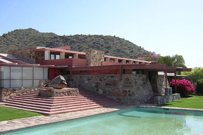
Photo: Lar (primary) User:Lar (secondary), Public domain
#14 · Landmark · 1 hr 56 min northwest
Taliesin West
Frank Lloyd Wright's winter home and studio in the desert foothills, seen on a guided tour.
- 1.5-2 hrs
- Year-round
- Tour ticket
Heads-up: Tickets are limited; book ahead. Paths are gravel with some steps.
Plan my day
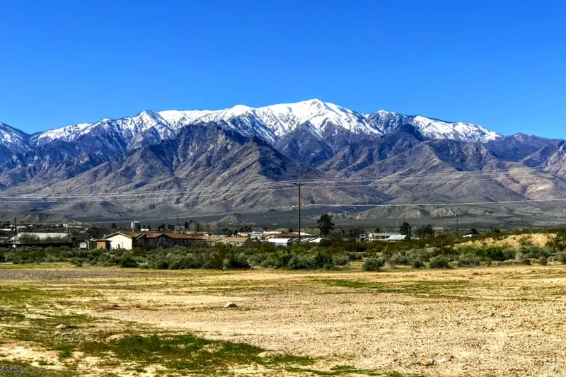
Photo: Jbparrish, CC BY-SA 4.0
#15 · Scenic drive · 2 hr 48 min northeast
Mount Graham and the Swift Trail
Climb more than 7,000 feet on the Swift Trail, from desert to spruce and aspen forest near Arizona's tallest sky-island peak, with cool picnic spots and trailheads on the way.
- Half day to full day
- Best May to mid-November; upper road closed to cars about November 15 to April 15
- Free to drive; day-use fee (per vehicle) at some sites such as Riggs Flat Lake
Heads-up: The first 22 miles are paved and the last 13 are dirt (high clearance). The upper gate closes to cars past Shannon Campground about November 15, and snow can close it earlier.
Plan my day