Photo: RuggyBearLA, CC BY 2.0
#1 · National park · 35 min southeast
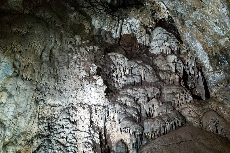
Timpanogos Cave National Monument
A ranger-led tour through colorful caves high on a cliff in American Fork Canyon, reached by a steep paved trail.
- Half day
- Mid-May to fall
- Cave tour ticket; entrance free
Heads-up: Tour tickets sell out, buy ahead on Recreation.gov. The trail climbs about 1,000 feet in 1.5 miles one way. No pets on the cave trail. Cashless.
Plan my day
Official site
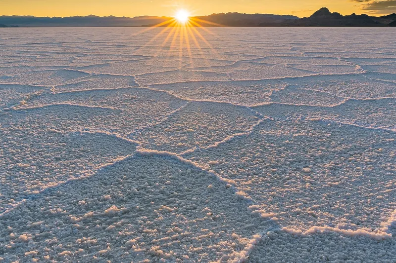
Photo: Asibasm, CC BY-SA 4.0
#2 · Viewpoint · 1 hr 24 min west
Bonneville Salt Flats
A huge, flat white salt plain near Wendover where you can walk out on the crust and watch mirages; famous for land speed racing.
- Half day
- Summer and fall (dry salt); flooded and closed to driving in winter and when wet
- Free
- Confirm fees and hours before you go
Heads-up: About 2 hours west of Salt Lake on I-80. The paved access road ends at a parking area. No driving on wet or flooded salt, towing costs a lot. No camping on the salt. Pet rules not posted. Rinse your…
Plan my day
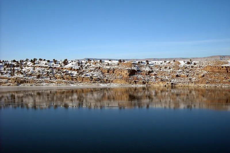
Photo: Staplegunther (talk)David Jolley, CC BY-SA 3.0
#3 · Swimming · 2 hr 4 min southeast
Fred Hayes State Park at Starvation
A large reservoir near Duchesne (formerly Starvation State Park) with a sandy swim beach, warm summer water and big desert views.
- Half day
- Summer (park open year-round)
- Utah State Parks day-use fee (per vehicle)
Heads-up: Summer water is in the low 70s. No dogs on the beaches or swimming areas; leashed dogs OK in camping areas. Quiet compared to Wasatch Front parks.
Plan my day
Official site
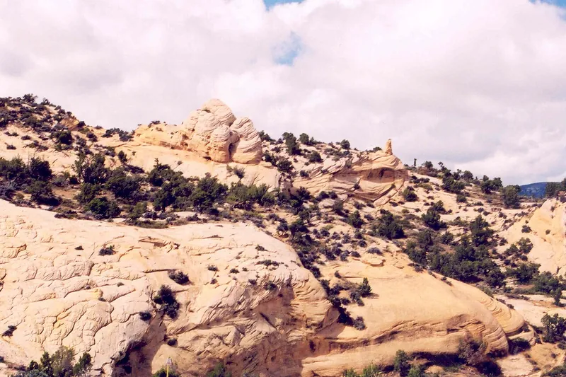
Photo: A. E. Crane, U.S. Department of Transportation, Public domain
#4 · Scenic drive · 2 hr 50 min east
Flaming Gorge-Uintas Scenic Byway
A drive on US-191 from Vernal up the Uinta Mountains to Flaming Gorge, with signs explaining the tilted rock layers along the way.
- Half day
- Year-round (snow in winter)
- Free
Heads-up: Steep grades and switchbacks. Stop at the geology signs and interpretive sites, and at Red Canyon.
Plan my day
Official site
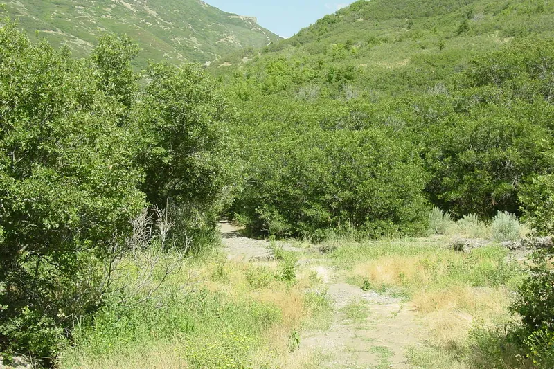
Photo: Helen854 at English Wikipedia, CC BY-SA 3.0
#5 · Bike trail · 26 min south
Corner Canyon
A big trail network in the Draper foothills with flowy mountain-bike trails, hiking paths and views of the valley.
- 2-3 hrs
- Spring to fall
- Free
Heads-up: Dogs on leash only on the Bonneville Shoreline Trail and trails below it; no dogs in the watershed above. Some trails are downhill bike-only (like Rush and Jacob's Ladder). Only Class 1 e-bikes.…
Plan my day
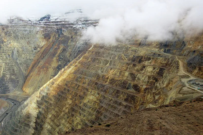
Photo: Farragutful, CC BY-SA 4.0
#6 · Historic site · 56 min southwest
Bingham Canyon Mine (Kennecott Visitor Experience)
An overlook into one of the world's biggest open-pit copper mines, with giant haul trucks and exhibits about mining.
- 2-3 hrs
- Mid-April to October 31 (daily)
- Admission (kids under 5 free)
Heads-up: Buy timed tickets online; cash not accepted and walk-ups can be turned away when full. Park in the lot and ride a shuttle to the overlook. Fully ADA accessible; call ahead for ADA reservations.
Plan my day
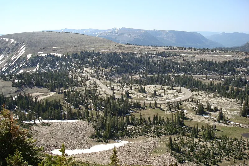
Photo: Glennfcowan, CC BY 3.0
#7 · Scenic drive · 1 hr 26 min east
Mirror Lake Scenic Byway
A high road from Kamas over Bald Mountain Pass into the Uinta Mountains, past dozens of lakes, waterfalls and viewpoints.
- Full day
- Late May or June to December (closed by snow in winter)
- Recreation pass for stops (Forest Service)
Heads-up: Driving through is free, but you need a pass to park at sites (fee tubes, ranger offices or online). Interagency passes accepted. Bring layers, it's over 10,000 ft.
Plan my day
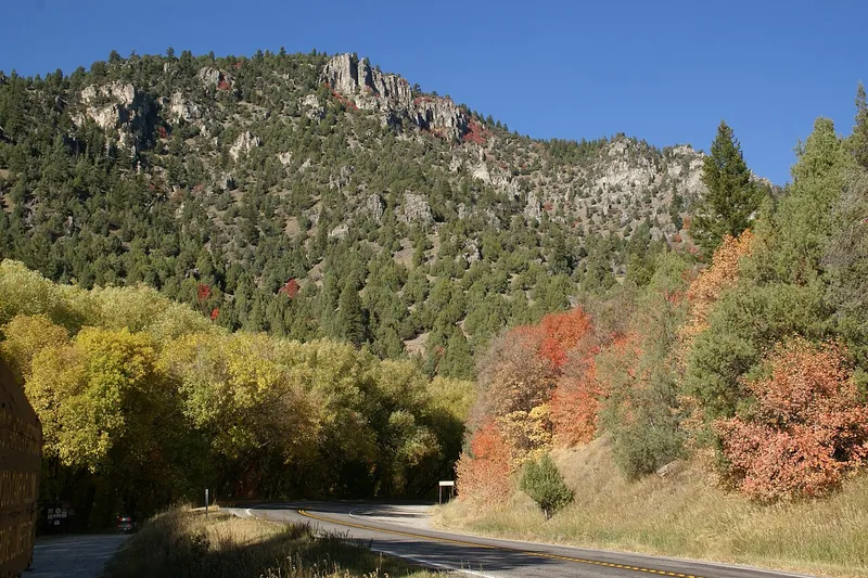
Photo: Hermann Luyken, CC0
#8 · Scenic drive · 1 hr 31 min north
Logan Canyon Scenic Byway
A 41-mile drive on US-89 from Logan to Garden City through limestone cliffs along the Logan River, with trailheads and picnic spots.
- Half day
- Year-round
- Free (some sites have fees)
Heads-up: Red maples low and gold aspens high in fall. Tops out at Bear Lake Summit, with an overlook of the turquoise lake.
Plan my day
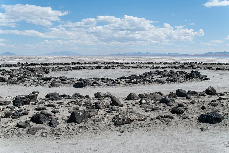
Photo: Matthew.kowal, CC BY-SA 4.0
#9 · Viewpoint · 1 hr 59 min northwest
Spiral Jetty
A famous earthwork made of black basalt rock that coils out into the pink-tinged north arm of Great Salt Lake.
- Half day
- Year-round (dry weather)
- Free
Heads-up: About 15.5 miles of gravel road past the Golden Spike visitor center; the last miles are rough, high clearance helps. Follow the small signs, not phone maps. No restrooms or cell service. Visibility…
Plan my day
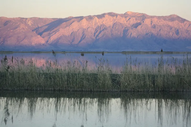
Photo: RhetoricallySpeaking, CC BY-SA 4.0
#10 · Viewpoint · 52 min north
Bear River Migratory Bird Refuge
A vast wetland west of Brigham City with a 12-mile auto tour route, huge flocks of birds and a visitor center.
- 2-3 hrs
- Year-round, sunrise to sunset (best spring and fall)
- Free
- Confirm fees and hours before you go
Heads-up: The regular auto tour was rerouted from April to mid-September 2026. Visitor center open Tuesday-Saturday. Pets on leash. Bring binoculars and bug spray.
Plan my day
Official site
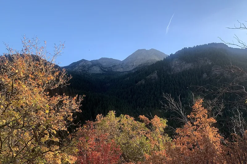
Photo: Paytonpingree, CC BY-SA 4.0
#11 · Scenic drive · 47 min southeast
Alpine Loop Scenic Byway
A narrow, winding mountain road (SR-92) around Mount Timpanogos, linking American Fork Canyon and Provo Canyon, gorgeous with fall colors.
- 2-3 hrs
- Late spring to about early November (closed in winter)
- Free to drive through; recreation pass to stop at sites
- Confirm fees and hours before you go
Heads-up: Closed to cars in winter. Not recommended for vehicles over 30 feet. Weekend fall-color traffic is heavy.
Plan my day
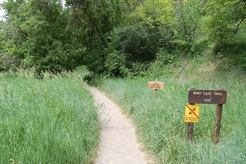
Photo: A. E. Crane, U.S. Department of Transportation, Public domain
#12 · Trail · 1 hr 27 min north
Wind Cave Trail (Logan Canyon)
A switchbacking climb to wind-carved arches and small caves in limestone cliffs above the Logan River, with views of the China Wall.
- 2-3 hrs
- Spring to fall
- Free
- Confirm fees and hours before you go
Heads-up: About 3.5 miles round trip with about 1,000 ft of climbing. Little shade, bring extra water. Parking fills on summer weekends. Dogs allowed.
Plan my day
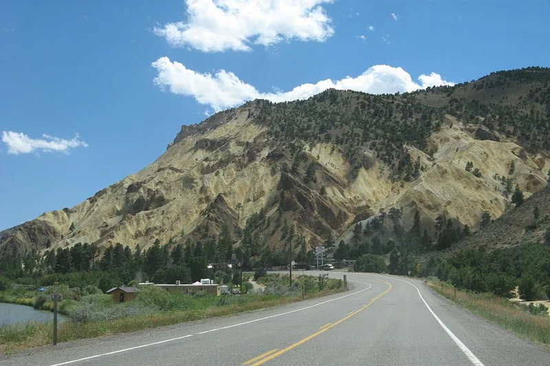
Photo: hakkun, CC BY-SA 3.0
#13 · Viewpoint · 2 hr 41 min south
Big Rock Candy Mountain
A colorful yellow and orange hill beside Highway 89 made famous by an old song, with a small resort and roadside stop.
- 1 hr
- Year-round
- Free
- Confirm fees and hours before you go
Heads-up: The resort offers river floats in warm months.
Plan my day
#14 · Theme park · 44 min south
Splash Summit Waterpark
Provo's water park (formerly Seven Peaks), with 16 slides including drop slides and a half-pipe tube ride, a big wave pool, a lazy river and kids' areas.
- Half day
- Late May to early September
- Admission
- Confirm fees and hours before you go
Heads-up: Formerly called Seven Peaks Provo. A virtual-reality slide (VRSlide) was added for 2026; riders must be 42 inches or taller.
Plan my day