Photo: formulanone, CC BY-SA 2.0
#1 · National monument · 43 min northwest
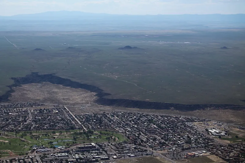
Petroglyph National Monument
Thousands of images pecked into dark volcanic boulders on Albuquerque's West Mesa, reached by several short canyon trails plus a volcano day-use area.
Heads-up: Boca Negra Canyon open 8:30-4:30 (last entry 4:00); Rinconada and Piedras Marcadas open sunrise to sunset. Leashed dogs allowed on Rinconada, Piedras Marcadas and Volcanoes trails but not at Boca…
Plan my day
Official site
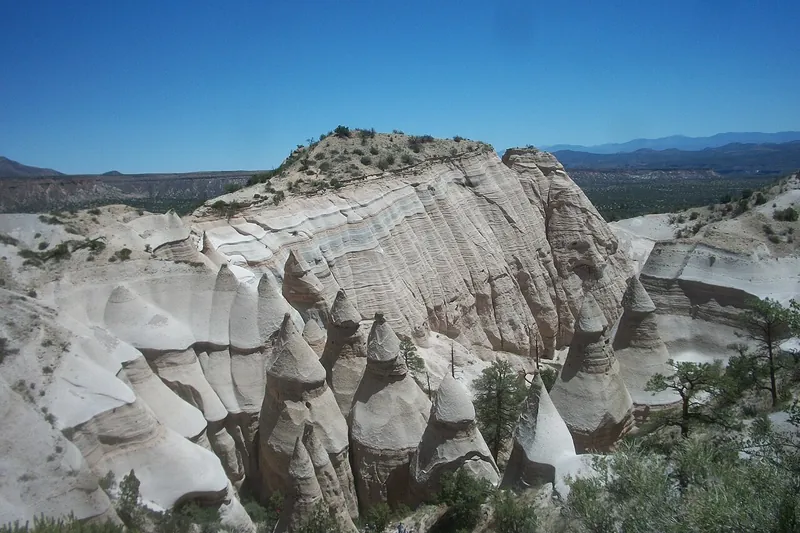
Photo: VitaleBaby at English Wikipedia, Public domain
#2 · National monument · 1 hr 3 min north
Kasha-Katuwe Tent Rocks National Monument
Cone-shaped tent rocks of volcanic ash on Cochiti Pueblo land, with a slot canyon trail that climbs to a mesa-top view.
- Half day
- Feb 1 to Dec 14, Thursday to Monday
- BLM ticket (per person) plus Cochiti Pueblo Tribal Access Pass
Heads-up: Reservation only on Recreation.gov, no day-of tickets; every person needs a ticket and passes do not cover the tribal fee. Entry 8 am to 1 pm, out by 4 pm, check in at the Cochiti Visitor Center. No…
Plan my day
Official site
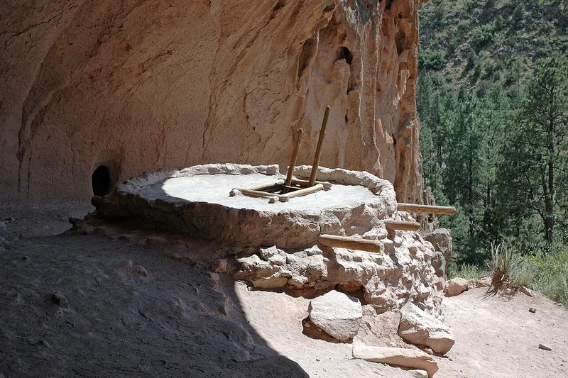
Photo: Unknown, Public domain
#3 · National monument · 1 hr 47 min north
Bandelier National Monument
A canyon of cliff dwellings and village ruins carved into soft volcanic tuff, with ladders up to alcove rooms along the Pueblo Loop Trail in Frijoles Canyon.
- Half day
- Year-round
- National park entrance fee (per vehicle) or America the Beautiful pass
Heads-up: Dogs only in the main parking lot, picnic area and campground, not on trails or the shuttle. The Pueblo Loop is not ADA accessible (steep grades, ladders). A free shuttle from White Rock runs on some…
Plan my day
Official site
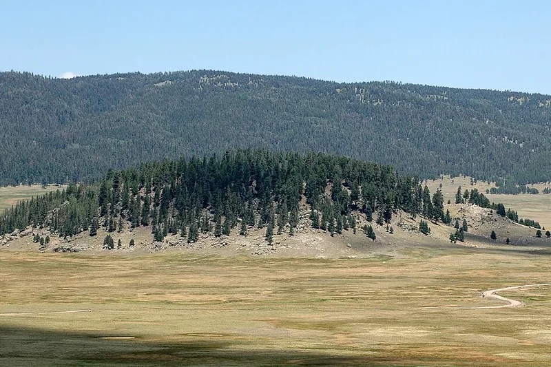
Photo: User Brian0918 on en.wikipedia, Public domain
#4 · National park · 1 hr 48 min north
Valles Caldera National Preserve
A huge volcanic caldera of open grass valleys ringed by forested domes, where elk herds graze and trails head out from the Cabin District.
- Half day
- Year-round
- National park entrance fee (per vehicle) or America the Beautiful pass
Heads-up: Vehicle gate usually 9 am to 5 pm (8 to 6 in summer), closed Thanksgiving and Christmas. No cash. Leashed dogs only on Cabin District, Cerro La Jara, Rabbit Mountain and South Valle Grande trails.…
Plan my day
Official site
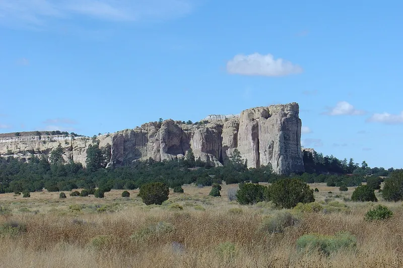
Photo: Joel Mills, CC BY-SA 3.0
#5 · National monument · 1 hr 52 min west
El Morro National Monument
A sandstone bluff where travelers carved names and messages for centuries, with a longer trail over the top.
- 2-3 hrs
- Year-round, Thursday to Monday
- Free
Heads-up: Open 9 to 5, closed Tuesday and Wednesday. Start the Inscription Loop by 4 pm and the Headland Trail by 2:30 pm. Ice can close the Headland in winter. Dogs on 6 ft leash, not in the visitor center.
Plan my day
Official site
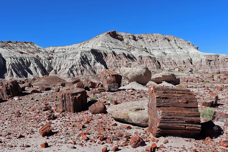
Photo: Jeffhollett, CC BY-SA 4.0
#6 · National park · 2 hr 58 min west
Petrified Forest National Park
Fallen logs turned to rainbow stone, Painted Desert views and old petroglyphs along a 28-mile park road.
- Half day
- Year-round (closed Thanksgiving, Christmas)
- NPS entrance fee
Heads-up: Taking any petrified wood is illegal. Leashed pets are welcome on trails and paved roads, but not in buildings.
Plan my day
Official site
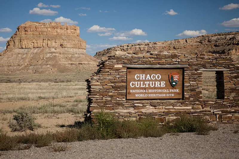
Photo: Greg Willis from Denver, CO, usa, CC BY-SA 2.0
#7 · National park · 2 hr 59 min northwest
Chaco Culture National Historical Park
Massive stone great houses of the Ancestral Puebloans in a remote desert canyon, seen from a loop drive and short trails.
- Full day
- Year-round
- National park entrance fee (per vehicle) or America the Beautiful pass
Heads-up: Long rough dirt road; the north road (CR 7950) is closed, so use the south route via Hwy 57 and call 505-786-7014 first. No gas or food. Dogs only on backcountry trails and in the campground, never…
Plan my day
Official site
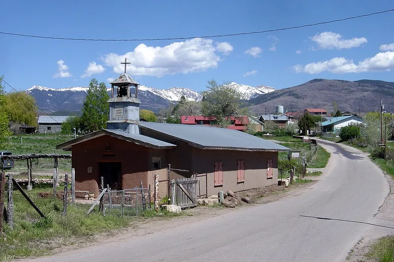
Photo: Bobak Ha'Eri, CC BY-SA 2.5
#8 · Scenic drive · 1 hr 14 min northeast
High Road to Taos
A 105-mile mountain route between Santa Fe and Taos through Spanish land-grant villages like Chimayo, Truchas and Las Trampas.
- Full day
- Year-round
- Free
- Confirm fees and hours before you go
Heads-up: About two hours without stops. Ends at San Francisco de Asis church in Ranchos de Taos. Picuris Pueblo is on the route; follow pueblo rules.
Plan my day
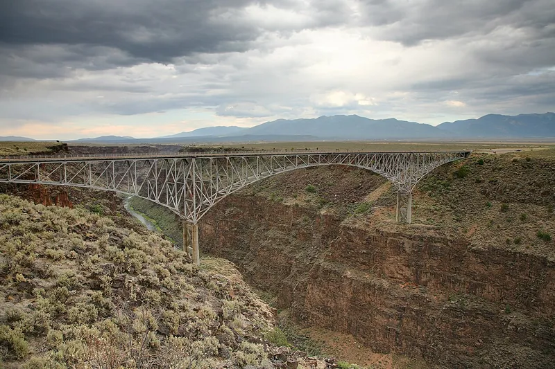
Photo: Daniel Schwen, CC BY-SA 4.0
#9 · Viewpoint · 2 hr 28 min northeast
Rio Grande Gorge Bridge
A tall steel bridge on US 64 northwest of Taos with dizzying views straight down into the Rio Grande Gorge.
Heads-up: About 12 miles northwest of Taos. Watch traffic when crossing.
Plan my day
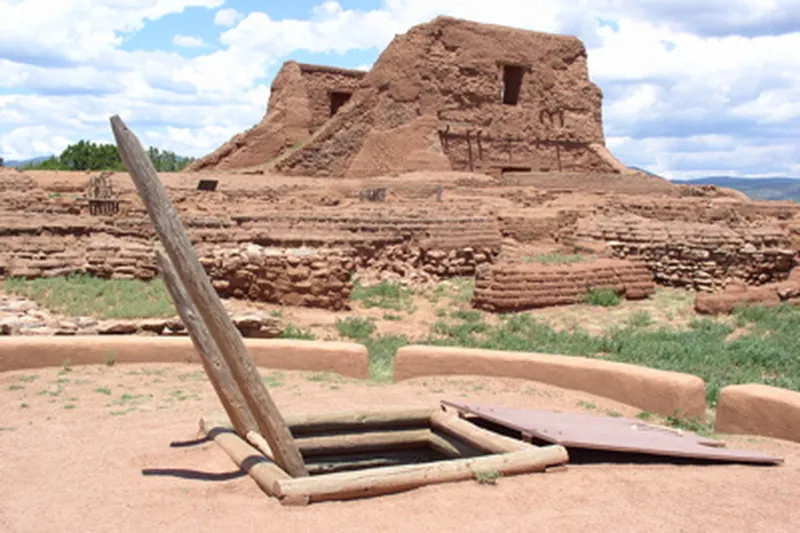
Photo: Mosamiazaz at English Wikipedia, Public domain
#10 · National park · 1 hr 19 min northeast
Pecos National Historical Park
Ruins of a great pueblo and a Spanish mission church in the Pecos River valley, along a loop trail with mountain views.
Heads-up: Leashed pets on two of three trails. The 1.25-mile Ancestral Sites Trail is only partly wheelchair friendly; a flat section starts at the church lot.
Plan my day
Official site
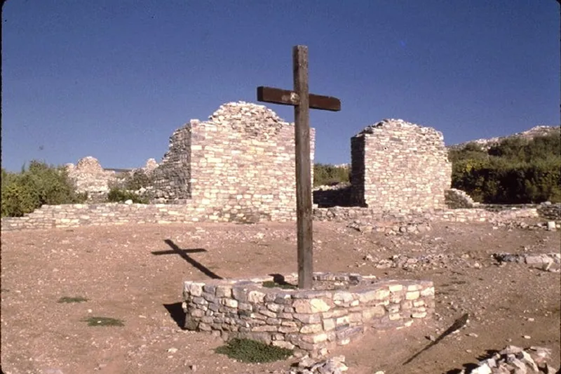
Photo: Unknown, Public domain
#11 · National monument · 1 hr 51 min southeast
Salinas Pueblo Missions National Monument
Three sites, Abo, Quarai and Gran Quivira, preserve the stone ruins of Spanish mission churches beside ancestral Pueblo villages.
Heads-up: Headquarters visitor center is in Mountainair. Sites open 9-5 in summer, 9-4 in winter. Leashed pets on trails and picnic areas but not in visitor centers. The sites are spread out, so plan driving…
Plan my day
Official site
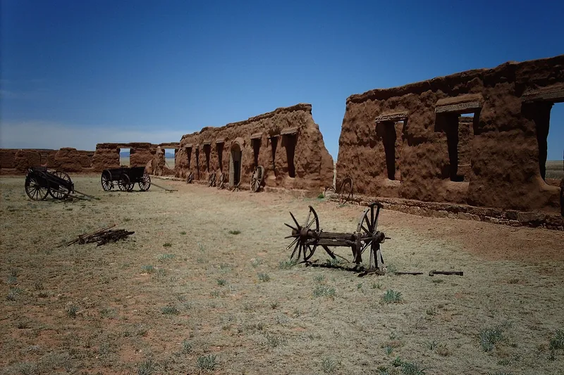
Photo: en:User:Nationalparks (Talk), CC BY-SA 2.5
#12 · National monument · 2 hr 11 min northeast
Fort Union National Monument
Adobe ruins of a frontier Army fort on the Santa Fe Trail, walked on a trail through the old post.
Heads-up: Open 8 am to 4 pm; closed Thanksgiving, Christmas and New Year's Day. Accessible trails. Windy and exposed, so bring a hat.
Plan my day
Official site
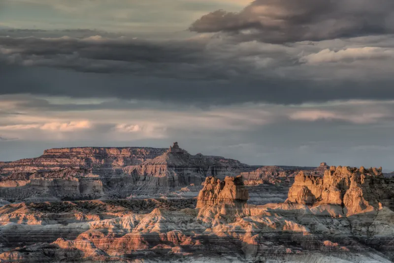
Photo: John Fowler, CC BY 2.0
#13 · Viewpoint · 2 hr 37 min northwest
Angel Peak Scenic Area
A rim-top overlook of colorful badlands below a tall sandstone peak, with a short interpretive rim trail.
Heads-up: Turn off US 550 about 15 miles south of Bloomfield. Gravel road can be impassable when wet. Free campground. Dogs on leash.
Plan my day
Official site
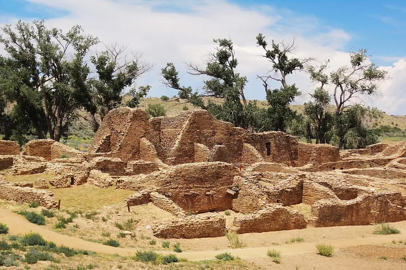
Photo: Rationalobserver, CC BY-SA 4.0
#14 · National monument · 2 hr 53 min northwest
Aztec Ruins National Monument
A large Ancestral Puebloan great house with original roofed rooms and a rebuilt Great Kiva you can walk into.
Heads-up: Self-guided trail about half a mile. Pets allowed only in the parking lot, picnic area and Old Spanish Trail, not on the ruins trail.
Plan my day
Official site
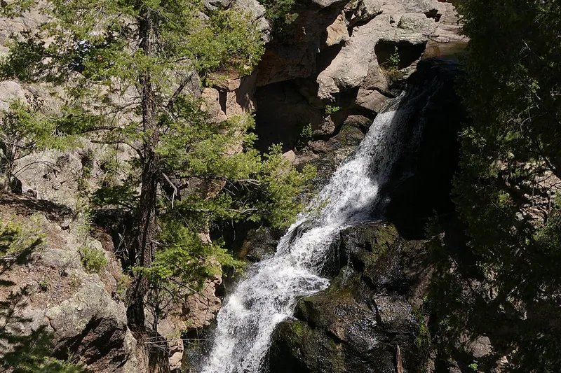
Photo: NMMIMAJ, CC BY-SA 3.0
#15 · Waterfall · 1 hr 38 min north
Jemez Falls
The tallest waterfall in the Jemez Mountains, reached by a quarter-mile walk from the trailhead to an overlook above the East Fork Jemez River.
- 1-2 hrs
- Spring to fall
- Day-use fee (per vehicle)
- Confirm fees and hours before you go
Heads-up: Dogs on leash. Day use only, vault toilet, no drinking water. Stay behind the overlook rail.
Plan my day