Photo: Lucas Löffler, Public domain
#1 · Canyon
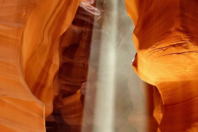
Antelope Canyon
A narrow slot canyon of swirling sandstone and light beams, seen on a guided Navajo tour.
- 1.5-2 hrs
- Year-round
- Guided tour ticket (Navajo Parks permit fee included)
Day Trippin' › Arizona › Best mountains and viewpoints
Our picks for the best mountains and viewpoints in Arizona: 44 places with a write-up, season and fees checked against official sites.
We put first the places with a real photo, a well-known name, a family-friendly note and an official site, then list the rest by name. Top picks: Antelope Canyon, Chiricahua National Park and Desert Botanical Garden.
Photo: Lucas Löffler, Public domain
#1 · Canyon
A narrow slot canyon of swirling sandstone and light beams, seen on a guided Navajo tour.
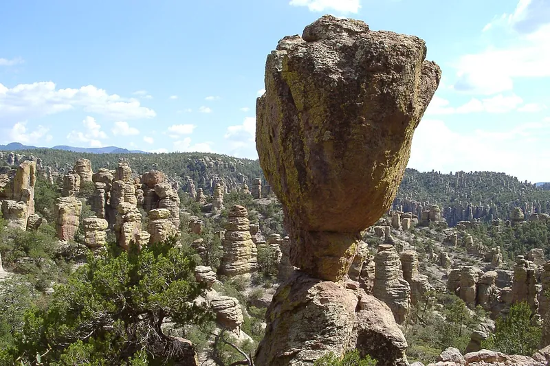
Photo: Pretzelpaws, CC BY-SA 3.0
#2 · National park
Drive Bonita Canyon up to Massai Point and look out over a forest of stone spires, then hike down among them on the Echo Canyon trail. America's newest national park (October 2026).
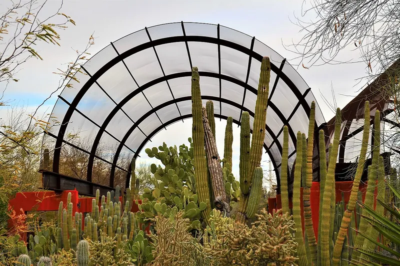
Photo: Scotwriter21, CC BY-SA 4.0
#3 · Garden
Thousands of desert plants along garden trails in Papago Park, beautiful in spring bloom.
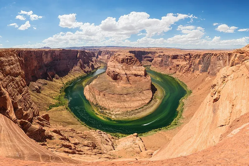
Photo: Thomas Wolf, www.foto-tw.de, CC BY-SA 3.0
#4 · Viewpoint
A short walk to a cliff edge where the Colorado River makes a giant horseshoe 1,000 feet below.
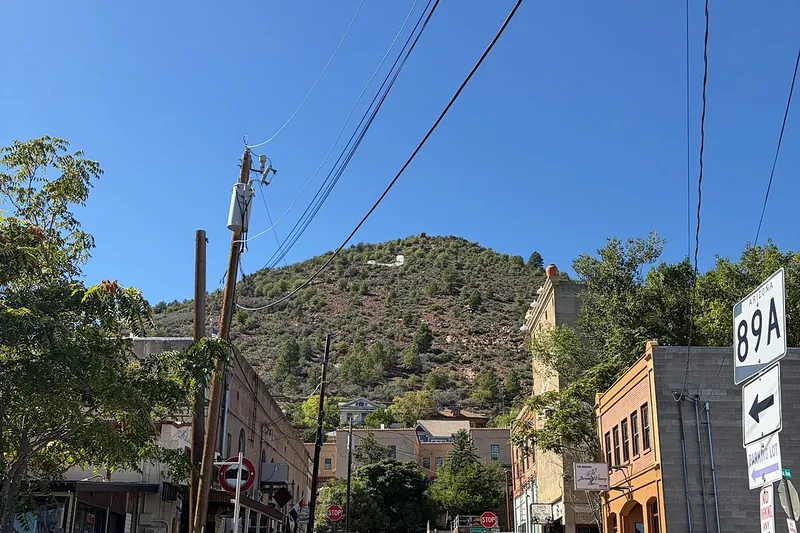
Photo: Seasider53, CC BY 4.0
#5 · Town
A former copper boomtown hanging off Cleopatra Hill, now full of galleries, tasting rooms and views.
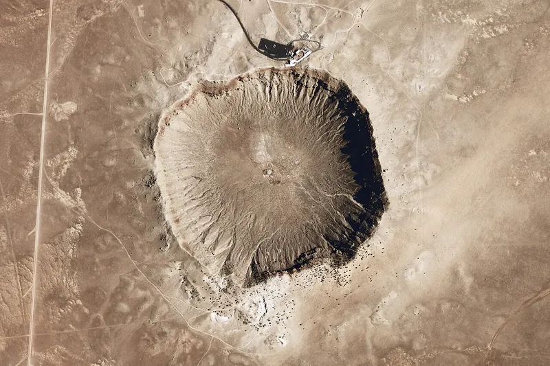
Photo: National Map Seamless Server, Public domain
#6 · Landmark
A nearly mile-wide crater left by a meteorite 50,000 years ago, with a museum on the rim.
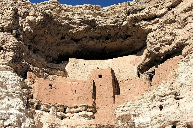
Photo: Beyond My Ken, CC BY-SA 4.0
#7 · National monument
A five-story Sinagua cliff dwelling tucked in a limestone cliff above Beaver Creek.
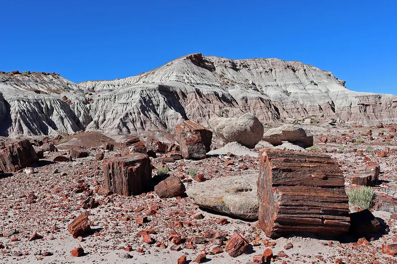
Photo: Jeffhollett, CC BY-SA 4.0
#8 · National park
Fallen logs turned to rainbow stone, Painted Desert views and old petroglyphs along a 28-mile park road.
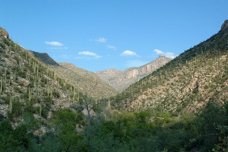
Photo: Lee Adlaf from Birmingham, AL, USA, CC BY 2.0
#9 · Canyon
A green desert canyon with a creek, pools and saguaro slopes. Ride the narrated shuttle up the canyon road, then walk back down or hike from the top stops.
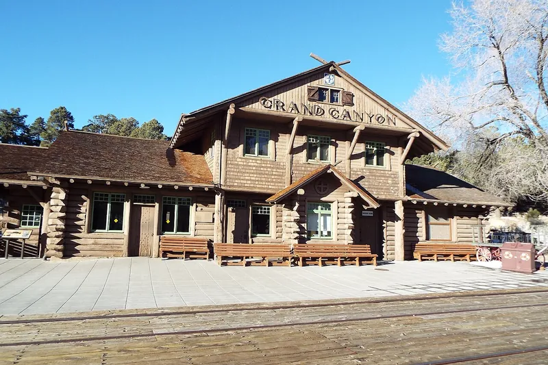
Photo: Marine 69-71, CC BY-SA 4.0
#10 · Viewpoint
The South Rim's main viewpoints, from Mather Point to Hopi Point, along a flat rim trail and free shuttles.

Photo: Guninvalid, CC0
#11 · Landmark
Walk across the 1831 granite bridge that was taken apart in London, numbered stone by stone and rebuilt over a channel in the desert, then stroll the Bridgewater Channel waterfront.
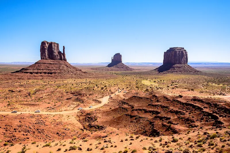
Photo: Domenico Convertini, CC BY-SA 2.0
#12 · Viewpoint
The famous sandstone buttes of the old Westerns, on a 17-mile loop drive or a Navajo-guided tour.
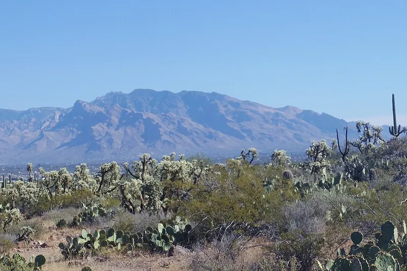
Photo: WClarke, CC BY-SA 4.0
#13 · Scenic drive
Climb from saguaro desert to pine forest in about an hour, with big viewpoints like Windy Point on the way up and pie and cabins in tiny Summerhaven near the top.
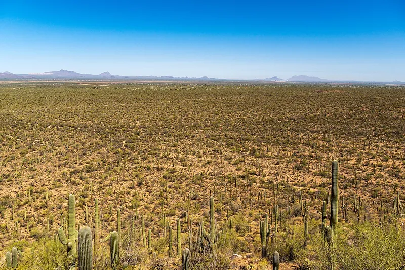
Photo: dconvertini, CC BY-SA 2.0
#14 · National park
The graded dirt Bajada Loop runs through some of the thickest saguaro forest anywhere, with a short climb at Signal Hill to boulders covered in ancient Hohokam rock carvings.
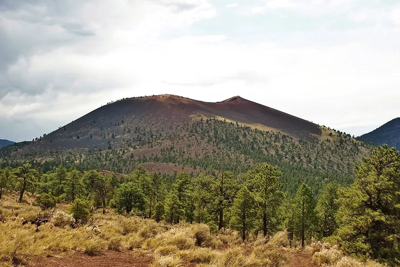
Photo: Mikesanchez1109, CC BY-SA 3.0
#15 · National monument
Walk lava flows and cinder fields at the foot of a volcano that erupted around 1085.
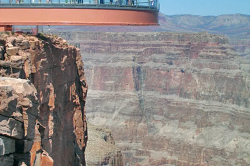
Photo: Complexsimplellc at English Wikipedia, CC BY 2.5
#16 · Viewpoint
Step onto the glass Skywalk at Eagle Point and ride the shuttle to other canyon-rim viewpoints, all on Hualapai tribal land.
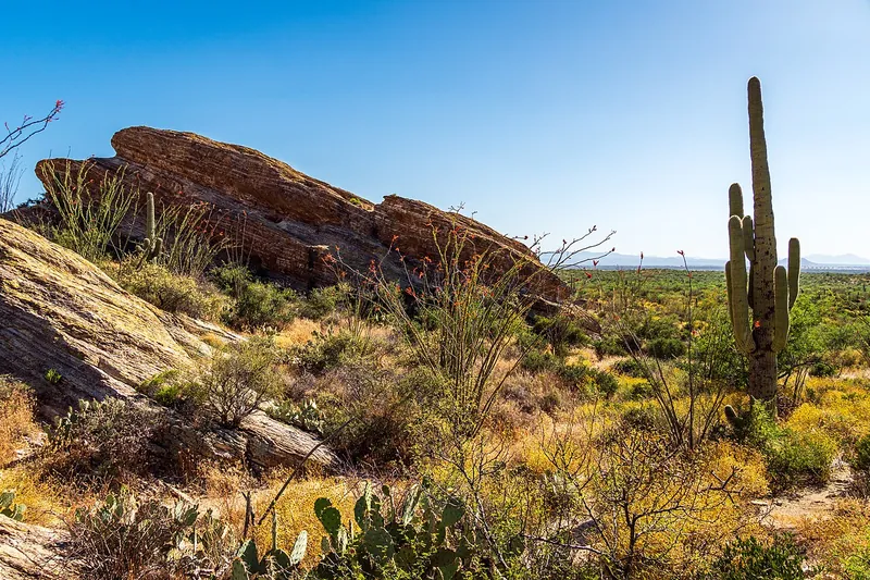
Photo: dconvertini, CC BY-SA 2.0
#17 · National park
Drive the paved 8-mile Cactus Forest Loop through thick stands of giant saguaros below the Rincon Mountains, with pull-offs and short walks on the way.

Photo: Marine 69-71, CC BY-SA 4.0
#18 · Landmark
An old Route 66 gas station turned roadside museum and gift shop, packed with vintage cars, signs and photo spots.

Photo: Elitemedia.network, CC BY-SA 4.0
#19 · Landmark
An experimental desert town of concrete domes and arches, famous for its bronze and ceramic wind bells.
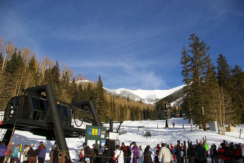
Photo: Frederick Dennstedt from los angeles, usa, CC BY-SA 2.0
#20 · Ski area
Ski in winter; in summer and fall ride the scenic gondola up the San Francisco Peaks to an overlook near 12,000 feet.
Casa Grande Ruins National Monument, Cave Creek Canyon, Coronado National Memorial, Crescent Moon Picnic Site, Desert View Watchtower, Gates Pass Scenic Overlook, Glen Canyon Dam, Imperial National Wildlife Refuge, Jerome State Historic Park, Katherine Landing, Kitt Peak National Observatory, Madera Canyon, Montezuma Well, Mount Graham and the Swift Trail, Oak Creek Canyon, Organ Pipe Cactus National Monument, Ramsey Canyon Preserve, Schnebly Hill Road, Sonoita and Elgin Wine Country, Taliesin West, Tohono Chul, Walnut Canyon National Monument, Woods Canyon Lake and the Rim Road, Wupatki National Monument
Our top picks are Antelope Canyon, Chiricahua National Park and Desert Botanical Garden. The page lists 44 in all.
We list 44, each with its season, fee and the time to allow.
14 need no pass or fee, including Chiricahua National Park, Jerome and London Bridge and Lake Havasu City. Fees change, so check each place.
33 of the 44 list themselves as open year-round, including Antelope Canyon, Chiricahua National Park and Desert Botanical Garden. Check hours before you go.
43 are marked family-friendly in our notes, including Antelope Canyon, Chiricahua National Park and Desert Botanical Garden.

Facts checked against official sites; passes, hours and prices change, so check before you go.