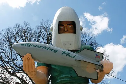
Gemini Giant
The 30-foot fiberglass astronaut from the old Launching Pad diner, now in South Island Park.
South Island Park, 201 Bridge St, Wilmington, IL 60481 · Directions
Photo: formulanone, CC BY-SA 2.0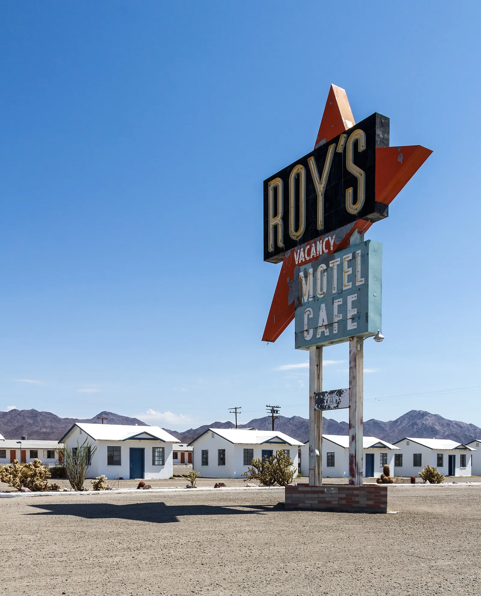
Chicago to Santa Monica on the Mother Road
★Route 66 turned 100 on November 11, 2026Neon motels, roadside giants, pie stops and the open desert, across eight states. Pick the stops you want on the map, check the weather for the month you go, then send the whole road trip to your free Trip Planner.
Rooms at all 11 overnight stops on Booking.com. Classic motels like the Blue Swallow and the Wigwam book up early.
Book nowOne-way: pick up at Chicago O'Hare (ORD), drop off at Los Angeles (LAX). Expect a one-way fee.
Book nowChicago river cruises, the Grand Canyon Railway from Williams and Grand Canyon tours.
See toursYou book directly with our partners, and they handle your reservation. Ready Set Go Adventure doesn't take bookings. Some links are affiliate links. We may earn a commission at no extra cost to you. Learn more
The drive in 11 days the way most road-trippers do it. Add any stop to your trip above; the builder re-plans your days.
Via Joliet, Wilmington, Pontiac, Bloomington
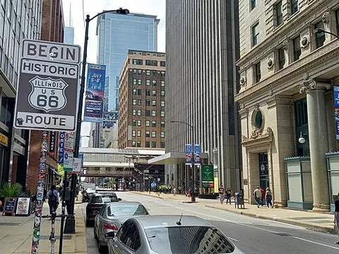
The brown sign where the road starts, a block from the Art Institute.
Chicago, IL 60603 · Directions
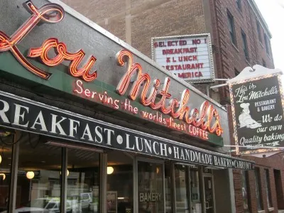
Breakfast since 1923, with free donut holes while you wait.
Chicago, IL 60661 · Directions · See menu
The 30-foot fiberglass astronaut from the old Launching Pad diner, now in South Island Park.
Wilmington, IL 60481 · Directions
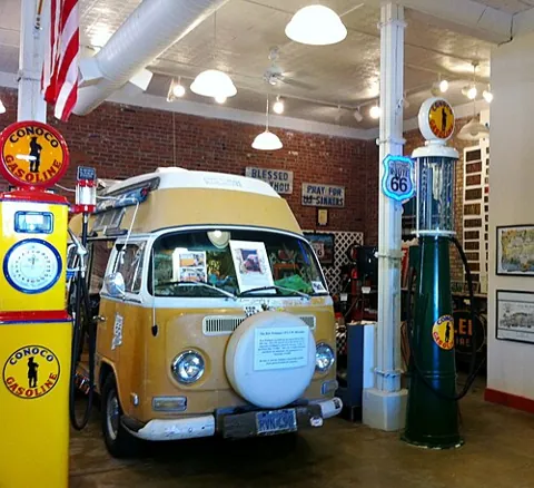
Free museum and alley murals, with Bob Waldmire's old bus.
Pontiac, IL 61764 · Directions
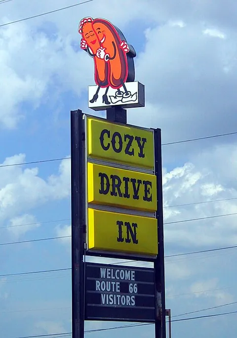
Home of the corn dog on a stick, since 1949.
Springfield, IL 62703 · Directions
Via Staunton, Chain of Rocks Bridge, St. Louis, Stanton
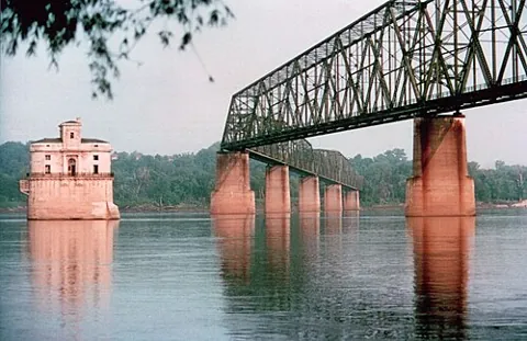
2 mi round trip · easy · A mile-long bridge over the Mississippi with a 22-degree bend. Walk or bike only.
St. Louis, MO 63137 · Directions
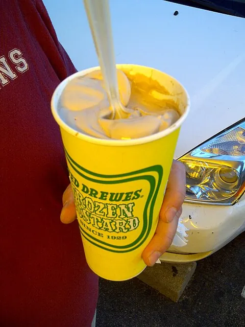
Custard "concretes" so thick they hand them over upside down.
St. Louis, MO 63109 · Directions · See menu
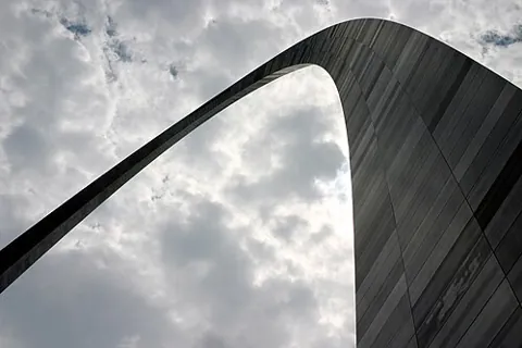
Ride the tram to the top of the 630-foot arch.
St. Louis, MO 63102 · Directions
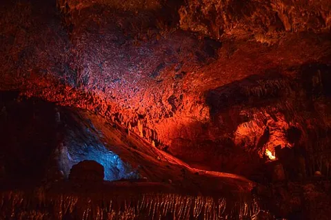
Big cave tours and a Jesse James hideout legend.
Sullivan, MO 63080 · Directions
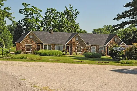
1930s stone cottages, one of the oldest motels still open on 66.
Cuba, MO 65453 · Directions
Via Rolla, Devil's Elbow, Springfield, Carthage
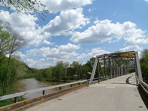
A 1923 steel bridge in a river bend.
Devil's Elbow, MO 65457 · Directions
Seventy-plus classic cars, right on 66.
Springfield, MO 65806 · Directions
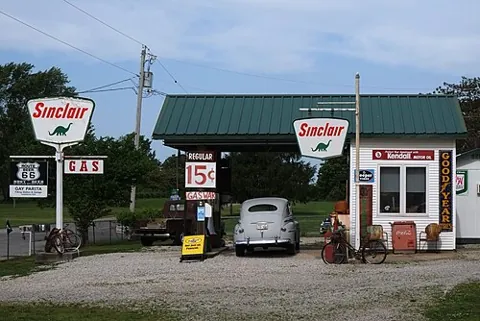
A rebuilt 1930s gas station with old cars out front.
Ash Grove, MO 65604 · Directions
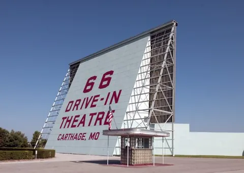
A 1949 drive-in that still shows movies from spring to fall.
Carthage, MO 64836 · Directions
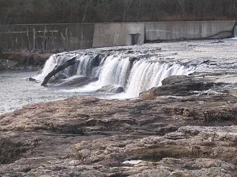
0.2 mi · easy · Missouri's largest continuous waterfall, five minutes from 66.
Joplin, MO 64804 · Directions
Via Galena KS, Miami, Catoosa, Tulsa, Arcadia
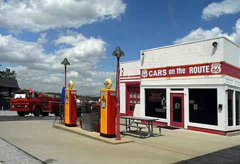
The rusty tow truck that inspired Tow Mater, on Kansas's 13 miles of 66.
Galena, KS 66739 · Directions
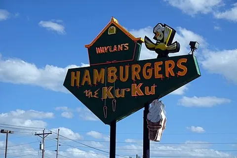
A 1965 burger stand with a giant cuckoo bird on the roof.
Miami, OK 74354 · Directions
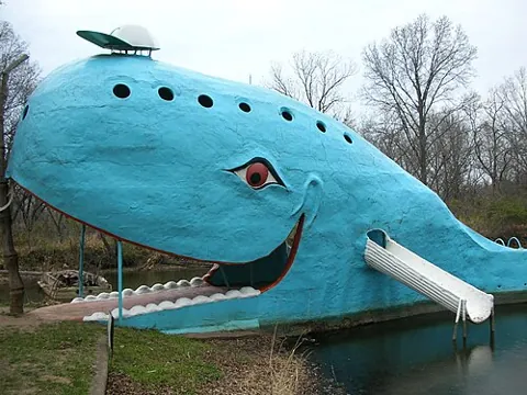
A smiling 80-foot whale built as an anniversary gift in the 1970s.
Catoosa, OK 74015 · Directions
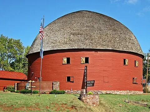
An 1898 round barn with a free museum in the loft.
Arcadia, OK 73007 · Directions
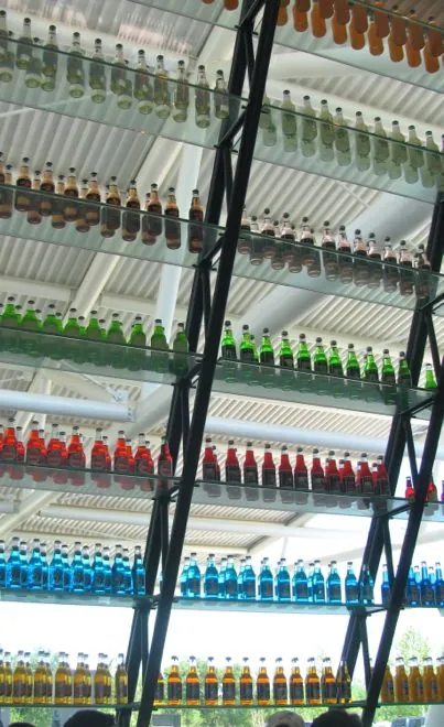
A 66-foot neon soda bottle and hundreds of sodas to pick from.
Arcadia, OK 73007 · Directions · See menu
Via El Reno, Hydro, Clinton, Elk City, Shamrock, Groom
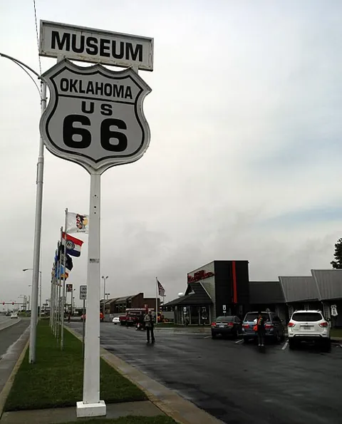
The road's story, decade by decade.
Clinton, OK 73601 · Directions
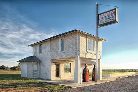
The 1929 station where Lucille Hamons sold gas for 59 years.
Hydro, OK 73048 (Route 66 at S Coleman Ave) · Directions
1-2 mi · easy · Red sandstone canyon trails, 10 minutes south of 66.
Hinton, OK 73047 · Directions
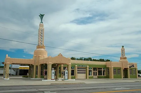
An art deco station and café, the model for Ramone's in Cars.
Shamrock, TX 79079 (NPS). Also listed as 1242 N Main St · Directions
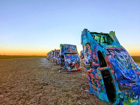
Ten Cadillacs nose-down in a field. Bring spray paint.
Amarillo, TX 79124 · Directions
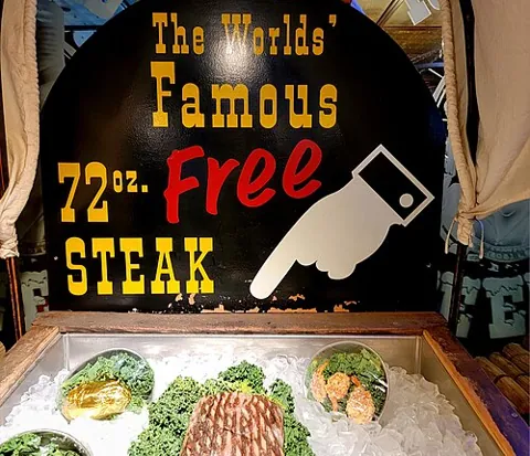
Free 72-ounce steak if you finish it in an hour.
Amarillo, TX 79118 · Directions · See menu
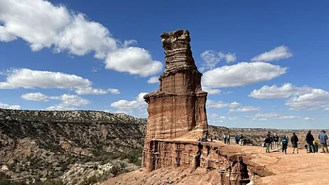
5.7 mi · moderate · The second-largest canyon in the US, 30 minutes from Amarillo.
Canyon, TX 79015 · Directions
Via Adrian, Tucumcari, Santa Rosa, Moriarty
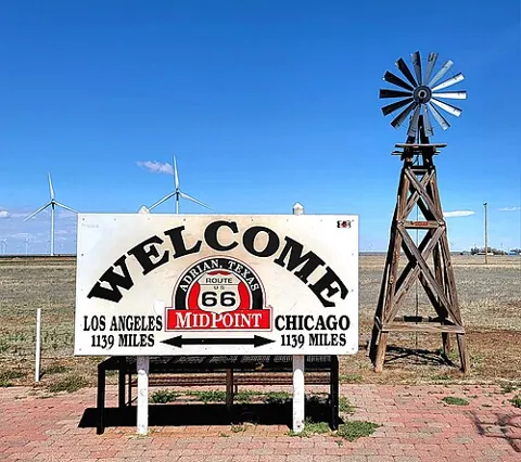
Halfway: 1,139 miles to Chicago and to LA. Get the pie.
Adrian, TX 79001 · Directions
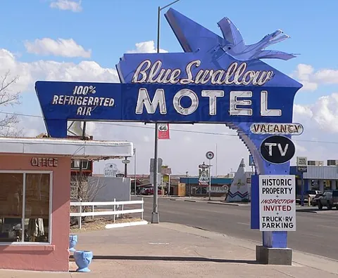
A 1939 motel with its own garages and famous neon.
Tucumcari, NM 88401 · Directions
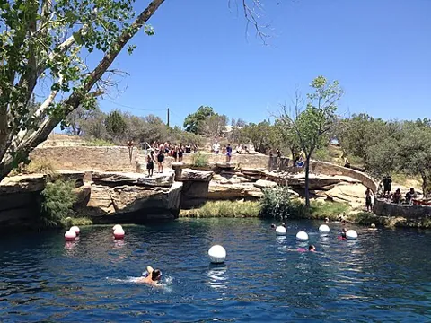
A clear spring 80 feet deep and 62°F all year. Swim or scuba.
Santa Rosa, NM 88435 · Directions
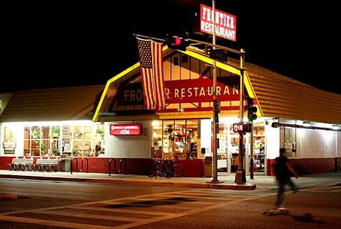
Sweet rolls and green chile on Central Ave, the old 66.
Albuquerque, NM 87106 · Directions
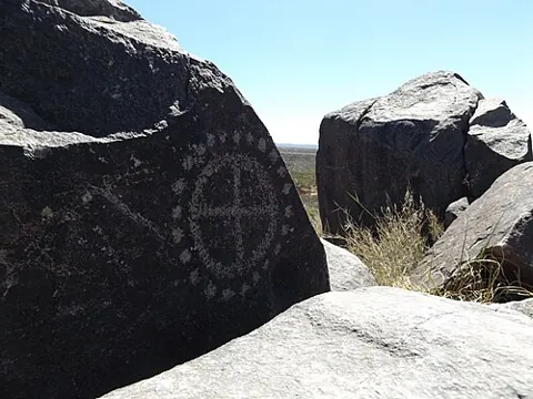
Rinconada Canyon 2.2 mi · easy · Thousands of rock carvings along an easy sandy trail.
Albuquerque, NM 87120 · Directions
Via Grants, Gallup, Petrified Forest
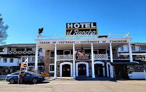
A lobby full of old Hollywood western stars; rooms named for them.
Gallup, NM 87301 · Directions
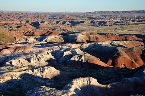
The only national park on Route 66, with a 1932 Studebaker on the old road.
Petrified Forest, AZ 86028 · Directions
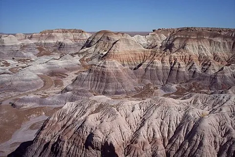
1 mi loop · easy · Blue and purple badlands with petrified logs along the path.
Petrified Forest National Park, AZ 86028 · Directions
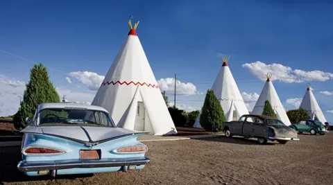
Sleep in a concrete teepee with vintage cars parked out front.
Holbrook, AZ 86025 · Directions
Via Winslow, Meteor Crater, Flagstaff
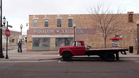
The corner from the Eagles song, with a mural and a flatbed Ford.
Winslow, AZ 86047 · Directions
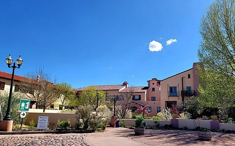
A 1930 railroad hotel restaurant, one of the best meals on 66.
Winslow, AZ 86047 · Directions · See menu
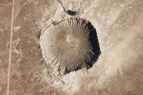
A mile-wide crater from an impact 50,000 years ago.
Winslow, AZ 86047 · Directions
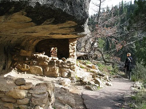
0.9 mi · moderate, 240 steps · Cliff dwellings tucked into a canyon wall.
Flagstaff, AZ 86004 (I-40 exit 204) · Directions
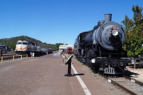
A vintage train from Williams to the South Rim and back in a day.
Williams, AZ 86046 · Directions
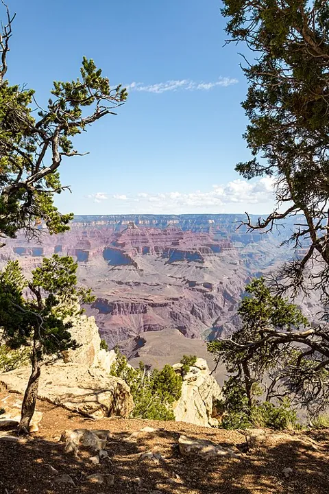
up to 13 mi · easy · The easy way to see the canyon: paved in parts, flat, shuttle stops along it.
Grand Canyon Village, AZ 86023 · Directions
Via Seligman, Peach Springs, Hackberry
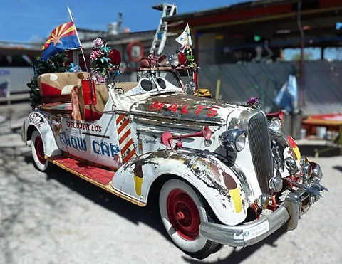
Jokes, fake mustard and "cheeseburgers with cheese" since 1953.
Seligman, AZ 86337 · Directions
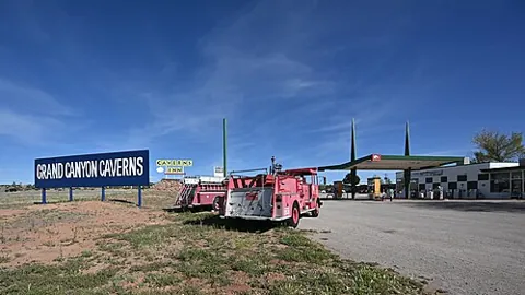
An elevator 21 stories down; you can even sleep in the cave.
Peach Springs, AZ 86434 · Directions
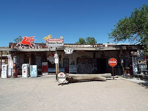
Old pumps, a red Corvette and the best gift shop on the road.
Hackberry, AZ 86411 · Directions
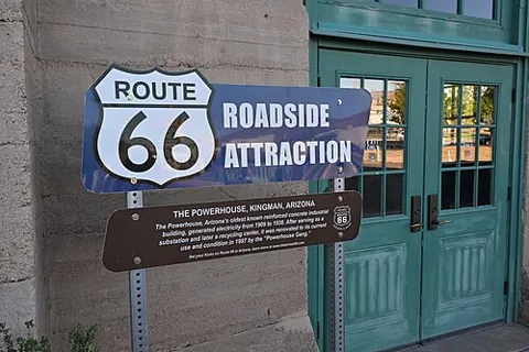
In the 1907 Powerhouse, next to an electric vehicle museum.
Kingman, AZ 86401 · Directions
Via Oatman, Needles, Amboy, Newberry Springs
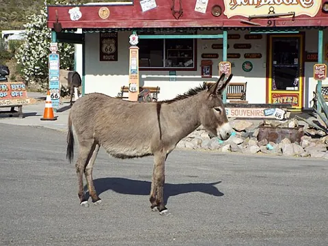
An old gold town where wild burros wander Main Street.
Oatman, AZ 86433 · Directions
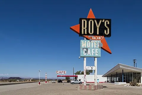
The 1959 boomerang sign in the middle of the Mojave.
Amboy, CA 92304 · Directions
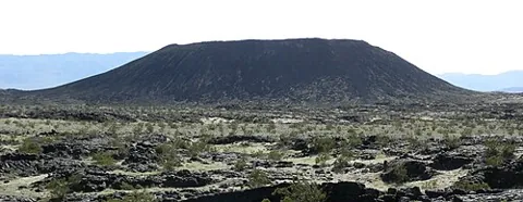
3 mi · moderate · Walk into a young volcanic cinder cone. Skip it on hot days.
Amboy, CA 92304 · Directions
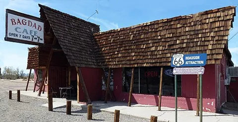
The café from the 1987 film, its walls covered in visitors' notes.
Newberry Springs, CA 92365 · Directions
Via Oro Grande, Cajon Pass, San Bernardino, Pasadena
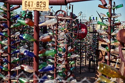
A forest of glass-bottle trees that chime in the wind. Free.
Oro Grande, CA 92368 · Directions
The other wigwam motel, renting rooms since 1949.
Rialto, CA 92376 · Directions
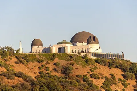
2.5 mi · moderate · City and Hollywood sign views at the top.
Los Angeles, CA 90027 · Directions
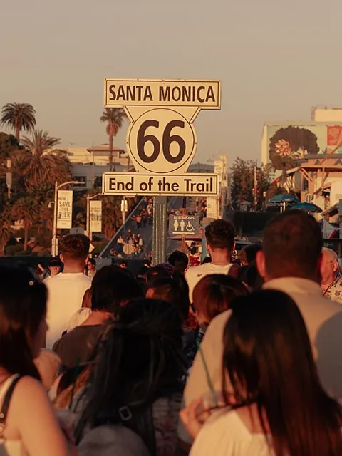
The "End of the Trail" sign. Take the photo: you made it.
Santa Monica, CA 90401 · Directions
Hotel links are affiliate links (Booking.com). We may earn a commission at no extra cost to you. Learn more · Map data © OpenStreetMap contributors
Old gas stations, roadside giants and motels most people drive right past on the interstate.
The 30-foot fiberglass astronaut from the old Launching Pad diner, now in South Island Park.
South Island Park, 201 Bridge St, Wilmington, IL 60481 · Directions
Photo: formulanone, CC BY-SA 2.0
1930s stone cottages, one of the oldest motels still open on 66.
901 E Washington St, Cuba, MO 65453 · Directions
Photo: JERRYE & ROY KLOTZ MD, CC BY-SA 4.0
A 1923 steel bridge in a river bend.
Teardrop Rd, Devil's Elbow, MO 65457 · Directions
Photo: Adam Jones from Kelowna, BC, Canada, CC BY-SA 2.0
A rebuilt 1930s gas station with old cars out front.
21118 Old Hwy 66, Ash Grove, MO 65604 · Directions
Photo: Gorup de Besanez, CC BY-SA 4.0
The rusty tow truck that inspired Tow Mater, on Kansas's 13 miles of 66.
119 N Main St, Galena, KS 66739 · Directions
Photo: Gorup de Besanez, CC BY-SA 4.0Share a hidden gem on Route 66 and we'll add it for the next road-trippers.
Share a favorite
Day 5 · The 1929 station where Lucille Hamons sold gas for 59 years.
Hydro, OK 73048 (Route 66 at S Coleman Ave) · Directions
Day 6 · A 1939 motel with its own garages and famous neon.
Tucumcari, NM 88401 · Directions
Day 7 · Sleep in a concrete teepee with vintage cars parked out front.
Holbrook, AZ 86025 · Directions
Day 9 · Old pumps, a red Corvette and the best gift shop on the road.
Hackberry, AZ 86411 · Directions
Day 10 · An old gold town where wild burros wander Main Street.
Oatman, AZ 86433 · Directions
Day 11 · A forest of glass-bottle trees that chime in the wind. Free.
Oro Grande, CA 92368 · Directions
Day 11 · The other wigwam motel, renting rooms since 1949.
Rialto, CA 92376 · Directions
Leg-stretchers and half-day hikes near the road. Green pins on the map.
Day 2 · 2 mi round trip · easy · A mile-long bridge over the Mississippi with a 22-degree bend. Walk or bike only.
St. Louis, MO 63137 · Directions
Day 3 · 0.2 mi · easy · Missouri's largest continuous waterfall, five minutes from 66.
Joplin, MO 64804 · Directions
Day 5 · 1-2 mi · easy · Red sandstone canyon trails, 10 minutes south of 66.
Hinton, OK 73047 · Directions
Day 5 · 5.7 mi · moderate · The second-largest canyon in the US, 30 minutes from Amarillo.
Canyon, TX 79015 · Directions
Day 6 · Rinconada Canyon 2.2 mi · easy · Thousands of rock carvings along an easy sandy trail.
Albuquerque, NM 87120 · Directions
Day 7 · 1 mi loop · easy · Blue and purple badlands with petrified logs along the path.
Petrified Forest National Park, AZ 86028 · Directions
Day 8 · 0.9 mi · moderate, 240 steps · Cliff dwellings tucked into a canyon wall.
Flagstaff, AZ 86004 (I-40 exit 204) · Directions
Day 8 · up to 13 mi · easy · The easy way to see the canyon: paved in parts, flat, shuttle stops along it.
Grand Canyon Village, AZ 86023 · Directions
Day 10 · 3 mi · moderate · Walk into a young volcanic cinder cone. Skip it on hot days.
Amboy, CA 92304 · Directions
Day 11 · 2.5 mi · moderate · City and Hollywood sign views at the top.
Los Angeles, CA 90027 · Directions
Diners, pie stops and classics. Menus open on each restaurant's own site, so they're always current.
Day 1 · Breakfast since 1923, with free donut holes while you wait.
Chicago, IL 60661 · Directions · See menu
Day 1 · Home of the corn dog on a stick, since 1949.
Springfield, IL 62703 · Directions
Day 2 · Custard "concretes" so thick they hand them over upside down.
St. Louis, MO 63109 · Directions · See menu
Day 4 · A 1965 burger stand with a giant cuckoo bird on the roof.
Miami, OK 74354 · Directions
Day 4 · A 66-foot neon soda bottle and hundreds of sodas to pick from.
Arcadia, OK 73007 · Directions · See menu
Day 5 · Free 72-ounce steak if you finish it in an hour.
Amarillo, TX 79118 · Directions · See menu
Day 6 · Halfway: 1,139 miles to Chicago and to LA. Get the pie.
Adrian, TX 79001 · Directions
Day 6 · Sweet rolls and green chile on Central Ave, the old 66.
Albuquerque, NM 87106 · Directions
Day 8 · A 1930 railroad hotel restaurant, one of the best meals on 66.
Winslow, AZ 86047 · Directions · See menu
Day 9 · Jokes, fake mustard and "cheeseburgers with cheese" since 1953.
Seligman, AZ 86337 · Directions
Day 10 · The café from the 1987 film, its walls covered in visitors' notes.
Newberry Springs, CA 92365 · Directions
Let someone else drive for a day.
 Viator · Day 1
Chicago Architecture River Cruise
See the city from the river before you start the drive. About 90 minutes.
See prices
 Viator · Day 6
Route 66 lore walk in Old Town Albuquerque
A guided noon stroll through Old Town with Route 66 stories.
See prices
 Viator · Day 8
Route 66 walking tour in Flagstaff
Downtown Flagstaff and its Route 66 history on foot.
See prices
 Viator · Day 8
Grand Canyon Railway from Williams
A vintage train to the South Rim and back in a day. Leave the car in Williams.
See prices
 Viator · Day 8
Small-group Grand Canyon day from Flagstaff
A guided day at the canyon so you can rest from driving.
See prices
 Viator · Day 11
Best of Los Angeles from Santa Monica
A half day of LA highlights once you reach the end of the trail.
See prices
Tour links are affiliate links. We may earn a commission at no extra cost to you.
About 2,400 miles from Chicago to Santa Monica, through Illinois, Missouri, Kansas, Oklahoma, Texas, New Mexico, Arizona and California.
Plan 10 to 14 days for the whole route. Shorter stretches, such as Arizona or New Mexico, work well as a long weekend.
April to June and September to October. Summer highs in the desert Southwest often pass 100 F, and winter snow can close high stretches in New Mexico and Arizona.
Prices, hours and drive times change, so check before you go. RSGA Team