
Grand Canyon National Park, CC BY 2.0
#1 · The first big view
Mather Point
The first viewpoint most visitors see, a few steps from the visitor center with a sweeping view into the canyon. It is the busiest spot at sunrise and sunset, so go in the middle of the morning or the evening and plan a quieter place for the sun.
- Cost Free with park entry
- Time 30 minutes
Official info
Map

Grand Canyon National Park, CC BY 2.0
#2 · Rocks with a view
Yavapai Geology Museum
A small museum with a giant window on the canyon and exhibits that explain the layers of rock. A good rainy-day stop and an easy way to understand what you are looking at.
- Cost Free with park entry
- Time 45 minutes
Official info
Map

Grand Canyon National Park, Public domain
#3 · The classic sunset
Hopi Point
The famous sunset viewpoint on Hermit Road, with a long view of the river and the sun dropping behind the rim. Arrive 45 minutes before sunset to find space, and be ready for a crowd in summer.
- Cost Free with park entry
- Time 1 to 2 hours
Official info
Map

Sharon Mollerus, CC BY 2.0
#4 · The classic hike below the rim
Bright Angel Trail
A steep switchback trail into the canyon with water at the resthouses in summer and shade in the morning. Walk down to the 1.5-mile or 3-mile resthouse and turn around; the climb back takes twice as long as the descent.
- Cost Free with park entry
- Time 2 to 5 hours
Official info
Map
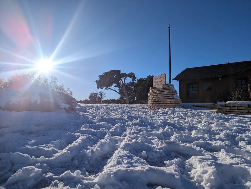
LilaF'ingRox, CC BY-SA 4.0
#5 · Mary Colter's stone tower
Desert View Watchtower
A 70-foot stone tower built in 1932 at the east end of the park, with murals inside and a view that includes the Colorado River. It is the best single stop on the drive and one of the best sunsets.
- Cost Free with park entry
- Time 1 hour
Official info
Map
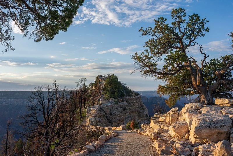
Grand Canyon National Park, CC BY 4.0
#6 · An easy North Rim walk
Bright Angel Point
A short paved trail with railings that ends on a narrow point with views into the canyon on both sides. It is the best first stop on the North Rim and works for most ages, but the drop is real.
- Cost Free with park entry
- Time 1 hour
Official info
Map

Mark Averitt, CC BY-SA 4.0
#7 · Two bridges over the river
Navajo Bridge and Marble Canyon
Two bridges cross Marble Canyon 470 feet above the Colorado River, with a free walkway on the old one and condors that sometimes perch below. A perfect stop between Page and the North Rim.
Official info
Map
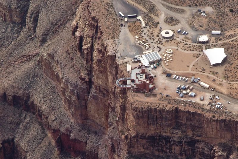
photo@kmatrix.de (Werner Keulen, labete), CC BY-SA 3.0
#8 · The glass bridge
Skywalk at Eagle Point
A horseshoe-shaped glass walkway that reaches 70 feet out from the rim, with the canyon about 4,000 feet below. It is a thrill for many people, but the canyon here is smaller than the South Rim, and the add-ons make it pricey.
- Cost Entry plus Skywalk about $75 to $125 (check)
- Time 1 hour
Official info
Map
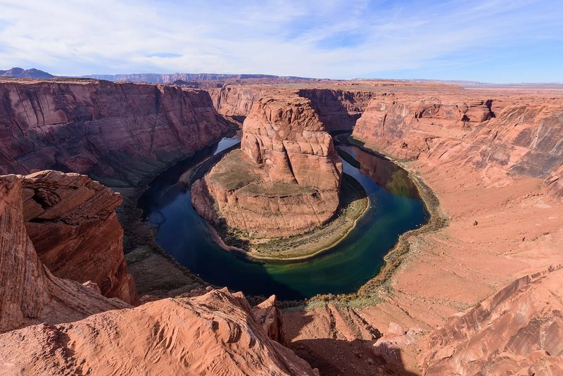
King of Hearts, CC BY-SA 4.0
#9 · The famous river curve
Horseshoe Bend
A short walk from the parking lot to a cliff with a view of the Colorado River making a 270-degree turn 1,000 feet below. It takes 20 minutes each way on a sandy path, has no shade and the railings are only in a few places, so stay back from the edge.
- Cost $10 per car for parking (check)
- Time 1 to 1.5 hours
Official info
Map

Mferbfriske, CC BY-SA 2.0
#10 · Glowing slot canyon walls
Antelope Canyon
A narrow sandstone slot canyon on Navajo land with glowing orange walls and light beams in the middle of the day. You can only enter with a Navajo guide, so choose Upper, Lower, X or a smaller secret canyon, and book ahead.
- Cost About $90 to $150 per person
- Time 1.5 to 2 hours
Official info
Map

NearEMPTiness, CC BY-SA 4.0
#11 · Vintage train to the rim
Grand Canyon Railway
A restored train from Williams to the Village, about 2 hours 15 minutes each way, with a Wild West show before departure. It is a classic family trip and an easy way to skip parking at the rim.
- Cost Check the site; tickets from about $70 to $250
- Time Full day
Official info
Map
#12 · Paved, flat and free
Rim Trail
A paved path along the rim for about 13 miles, with benches and views at every turn. Walk any piece you like and use the shuttle to get back, with the Village to Mather Point stretch the most popular.
- Cost Free with park entry
- Time 1 to 3 hours
Official info
Map
#13 · End of the road
Hermits Rest
A stone rest house at the west end of Hermit Road with a snack counter, a gift shop and fewer people than the Village. Ride the shuttle to the end and get off at viewpoints on the way back.
- Cost Free with park entry
- Time 1 hour
Official info
Map
#14 · Old lodges on the rim
Grand Canyon Village Historic District
The historic center of the South Rim, with El Tovar, Bright Angel Lodge, the Kolb Studio and Mary Colter buildings. A stroll takes an hour and the architecture is worth it even if you are not staying.
- Cost Free with park entry
- Time 1 hour
Official info
Map
#15 · Wide-open views, no water
South Kaibab Trail
A steep trail with some of the best views in the park and no shade or water. Ooh Aah Point is a short, rewarding walk; Cedar Ridge is a good turnaround. Take the shuttle to the trailhead because there is no parking.
- Cost Free with park entry
- Time 2 to 4 hours
Official info
Map
#16 · Paved path for bikes
Grand Canyon Greenway Trail
A paved multi-use path that links the visitor center, the Village and the trailheads. Rent a bike in the Village and ride it in the morning when the shuttle is full.
- Cost Free; rentals about $20 to $40
- Time 1 to 2 hours
Official info
Map
#17 · Start here for the shuttle map
Grand Canyon Visitor Center
The park visitor center near Mather Point has maps, ranger programs and the shuttle hub. Pick up the park newspaper and check the daily ranger talk schedule.
- Cost Free with park entry
- Time 30 minutes
Official info
Map
#18 · Sunrise and a view of the river
Lipan Point
A wide viewpoint with a long stretch of the Colorado River visible below and room for a crowd. One of the best sunrise and sunset spots in the park, with far fewer people than Hopi Point.
- Cost Free with park entry
- Time 30 minutes
Official info
Map
#19 · A quiet viewpoint
Grandview Point
A forested viewpoint with a big view of the eastern canyon, used by the first miners and visitors. Usually quiet, with the Grandview Trail leaving from the rim for hikers.
- Cost Free with park entry
- Time 30 minutes
Official info
Map
#20 · An ancient village on the rim
Tusayan Ruin and Museum
The remains of a small Ancestral Puebloan village about 800 years old, with a tiny museum next door. A short stop that shows people lived here long before the park.
- Cost Free with park entry
- Time 30 minutes
Official info
Map
#21 · A gorge on Navajo land
Little Colorado River Gorge Navajo Tribal Park
Two overlooks on Highway 64 look into the deep gorge of the Little Colorado River, with Navajo vendors selling jewelry along the road. Pay the small fee and stop for the view on the way to or from Page.
- Cost Small fee (check)
- Time 30 minutes
Official info
Map
#22 · The long drive that pays off
Cape Royal
A 23-mile scenic drive on the plateau ends at Cape Royal, a point with views of the river, Angels Window and the east end of the canyon. Plan half a day and bring a picnic.
- Cost Free with park entry
- Time 3 to 4 hours
Official info
Map
#23 · The highest point on the rim
Point Imperial
At 8,800 feet, the highest viewpoint in the park, with a view of the Painted Desert, Marble Canyon and the river. Good at sunrise and a short drive from the lodge area.
- Cost Free with park entry
- Time 30 minutes
Official info
Map
#24 · Hike down from the quiet rim
North Kaibab Trail
The main trail from the North Rim, with shady switchbacks and a trailhead a few miles from the lodge. A short hike to the Coconino Overlook or Supai Tunnel is a good half-day walk.
- Cost Free with park entry
- Time 2 to 4 hours
Official info
Map
#25 · Where the river turns cold and green
Lees Ferry
A historic river crossing at the start of the Grand Canyon, with a boat ramp, a short hike and good fishing below Glen Canyon Dam. A quiet, easy stop on the way between Page and the North Rim.
- Cost Small fee (check)
- Time 1 hour
Official info
Map
#26 · A 360-degree view
Guano Point
A rocky point with a view of the river and the Hualapai land, reached by the park shuttle. A short, windy walk and a popular lunch stop at the west end.
- Cost With Grand Canyon West entry
- Time 1 hour
Official info
Map
#27 · The big dam on the way
Hoover Dam
The 1930s dam on the Colorado River is on the road from Las Vegas to the West Rim, with a free walk on the bypass bridge. Stop on the way out and look at the dam from the bridge before you decide whether to tour it.
- Cost Free to view; tours cost extra
- Time 1 hour
Official info
Map
#28 · A Route 66 time capsule
Hackberry General Store
A roadside store with old cars, signs and Route 66 memorabilia, on the old highway between Kingman and Seligman. A fun stop on the long drive to the South Rim.
Official info
Map
#29 · An underground detour
Grand Canyon Caverns
Cave tours 21 stories below the Route 66 desert, with a restaurant and a motel on the road. A different side of the Grand Canyon region, and good in hot weather.
- Cost About $25 and up (check)
- Time 1 hour
Official info
Map
#30 · Raft the Colorado
Hualapai River Runners
Day rafting on the river at the bottom of the canyon, with a helicopter ride in and out. A once-in-a-lifetime trip, but it costs hundreds of dollars and runs in the warmer months.
- Cost Check the tour site
- Time Full day
Official info
Map
#31 · Stairs and narrow turns
Lower Antelope Canyon
The lower canyon is a longer slot with stairs and tight turns, and is often less crowded than Upper Antelope Canyon. It can be steep and narrow, so it is harder for people with mobility problems.
- Cost About $75 to $100 per person
- Time 1.5 hours
Official info
Map
#32 · Free view of the dam
Glen Canyon Dam and Carl Hayden Visitor Center
A free overlook and visitor center at the concrete dam that holds back Lake Powell, with a bridge view of the river downstream. Easy, free and good to combine with Horseshoe Bend.
Official info
Map
#33 · Red cliffs and blue water
Lake Powell
A huge reservoir of red-rock canyons and quiet coves just outside Page. The easy way to see it is a boat tour, kayak or a swim at Lone Rock Beach; water levels vary through the year.
- Cost Boat tours from about $50; park fee for the recreation area
- Time 2 to 4 hours
Official info
Map
#34 · Raft below the dam
Horseshoe Bend Float Trip
A half-day raft trip on the calm Colorado River below Glen Canyon Dam, passing under the cliffs and ending near Horseshoe Bend. It is relaxing, family-friendly and gives a different view than the overlook.
- Cost About $100 to $150 per person
- Time Half day
Official info
Map
#35 · Beach and sunset on Lake Powell
Lone Rock Beach
A sandy beach on Lake Powell with a view of a rock island, popular for camping, swimming and sunset photos. A good free-ish end to a day of slot canyons.
- Cost Park fee applies (check)
- Time 1 to 2 hours
Official info
Map
#36 · A free loop around town
Rim View Trail
A 10-mile loop trail on the rim above Page with views of the lake and Navajo Mountain. Walk or bike a piece; it is free, flat and a good way to use time before an Antelope Canyon tour.
- Cost Free
- Time 1 to 2 hours
Official info
Map
#37 · Drive-through animal park
Bearizona Wildlife Park
A drive-through wildlife park in Williams with bears, wolves and bison, plus a walk-through area with smaller animals. A fun stop with kids on the way to or from the canyon.
- Cost About $30 and up (check)
- Time 2 to 3 hours
Official info
Map
#38 · A walkable main street
Route 66 in Williams
The last Route 66 town to be bypassed by the interstate, with neon signs, diners, gift shops and pie. A pleasant evening walk after a day at the rim.
Official info
Map
#39 · Short film in Tusayan
IMAX Grand Canyon Theater
A giant-screen film about the canyon in Tusayan, about 10 minutes from the gate. A good rainy-day or windy-day stop, but only if you want a break; the real canyon is better.
- Cost About $15 (check)
- Time 1 hour
Official info
Map
#40 · Where Pluto was found
Lowell Observatory
A hilltop observatory in Flagstaff with evening telescope viewing, a planetarium and daytime tours. A good clear-night stop and a fit with the park's dark sky.
- Cost About $25 (check)
- Time 2 hours
Official info
Map
#41 · A cinder cone near Flagstaff
Sunset Crater Volcano National Monument
A cone about 1,000 feet high with a lava flow trail at the base, on the loop road north of Flagstaff. Combine it with Wupatki ruins for a day out on the way to Page.
- Cost About $25 per vehicle (check)
- Time 2 hours
Official info
Map
#42 · Pueblo ruins in the desert
Wupatki National Monument
Ancestral Puebloan homes and a ballcourt on the road from Flagstaff to Cameron, an easy stop that fits the drive to Page. The visitor center and the Wukoki Pueblo are the highlights.
- Cost About $25 per vehicle (check)
- Time 1.5 hours
Official info
Map
#43 · Day trip · Red rocks 2 hours south
Sedona
The red-rock town about 2 hours 15 minutes from the South Rim. Add a day for Cathedral Rock and the Chapel of the Holy Cross, and see our Sedona guide for the full plan.
- Time Full day or overnight
Official info
Map
#44 · Day trip · Hoover Dam and the city
Las Vegas
The city is about 4.5 hours from the South Rim and 2.5 hours from the Skywalk. A good starting or ending point; see our Las Vegas guide for the trip.
Official info
Map